
Mahanadi River Flood Crisis Sparks High Alert Across Odisha Districts
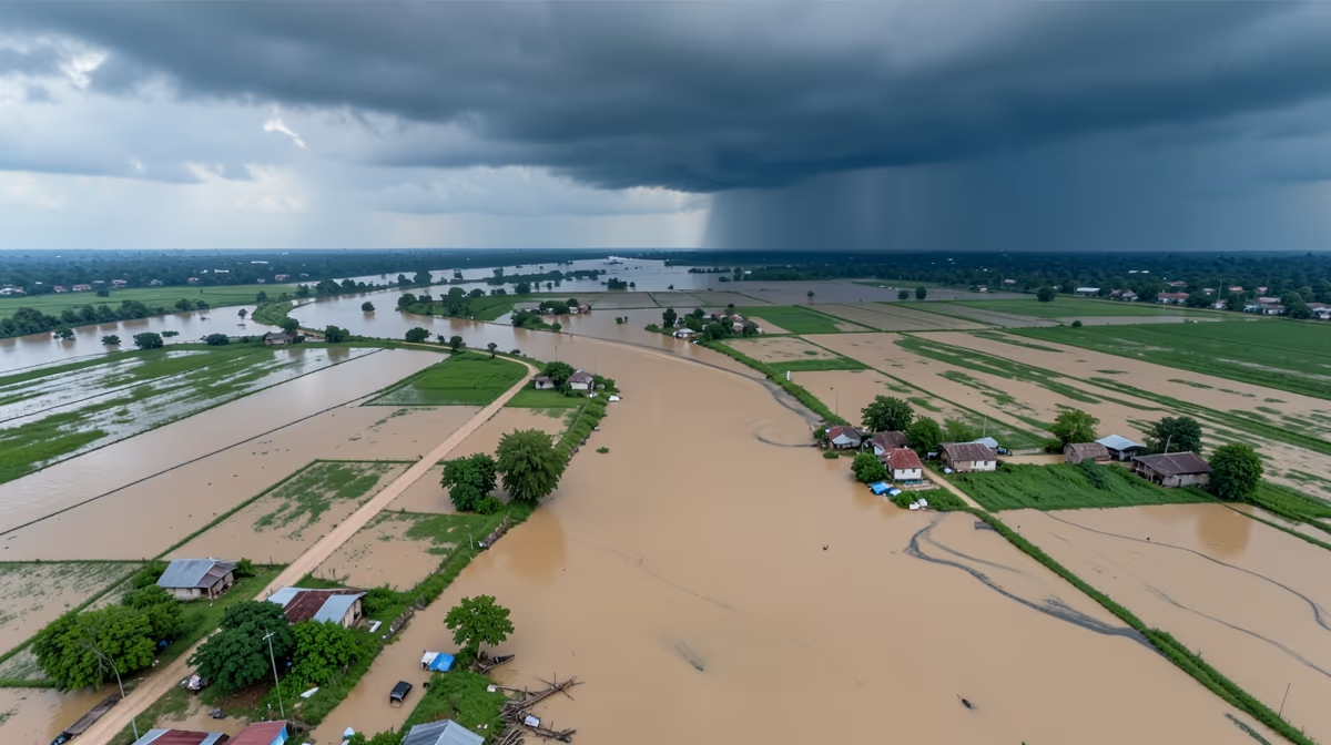
Bhubaneswar, Odisha — Water levels in the Mahanadi river system crossed danger marks at multiple points on Friday following incessant upstream rainfall, prompting the state government to issue high alerts across low-lying districts. The flood situation near mahanadi river has escalated rapidly following heavy rainfall and subsequent water discharge from major reservoirs, threatening vulnerable communities across the delta region.
Chronology of the Crisis
The unfolding crisis follows a clear timeline that began with the monsoon onset and the rapid filling of Hirakud reservoir capacity. This was followed by unprecedented heavy rainfall in the upper catchment areas of Chhattisgarh, which forced the emergency opening of sluice gates and triggered downstream inundation. The resulting surge has led to the widespread displacement of rural communities and the breach of vulnerable embankments, pushing authorities into the current phase of emergency rescue operations and initial damage assessments.
Current On-Ground Realities
The swelling of the Mahanadi river has triggered severe concerns of potential flooding in several districts, including Cuttack, Kendrapara, Jagatsinghpur, and Puri. The Hirakud Dam authorities have opened additional sluice gates to safely release excess water accumulating in the reservoir due to persistent heavy showers in the upper catchment areas of neighboring Chhattisgarh. District administrations have been placed on high alert, with disaster response teams deployed strategically to vulnerable riverbank settlements. Evacuation warnings have been issued for residents residing in extremely low-lying areas, while local authorities set up temporary relief shelters equipped with necessary food supplies and medical aid. Agriculture and infrastructure are expected to face immediate impacts if water levels continue to rise over the next 24 hours. Standing paddy crops in riparian zones are at risk of inundation, and rural connectivity roads are being closely monitored for structural integrity as river currents intensify.
Root Causes and Structural Pressures
A deeper examination of the basin reveals multiple compounding factors behind the disaster. The root cause stems from unregulated upstream dam discharges from Hirakud compounded by unprecedented siltation in the deltaic branches and intense, localized cloudbursts driven by erratic monsoon patterns. Furthermore, unchecked illegal sand mining in the riverbed has altered natural drainage morphology and worsened flood surges by reducing channel capacity. These structural vulnerabilities mirror historical parallels such as the devastating 1982 Mahanadi floods, which reshaped regional embankment policies and highlighted systemic drainage failures.
Socio-Economic and Political Fallout
The human and financial toll of the inundation is mounting rapidly across the affected districts. Economically, the region is facing massive crop losses in Odisha's rice bowl, disruption of local supply chains, infrastructural damage to roads and bridges, and escalating fiscal pressure on disaster relief budgets. On the political front, tensions have surfaced through a blame game between central and state agencies over disaster management fund allocation, alongside electoral maneuvering in affected rural constituencies where agrarian distress dictates voting behavior. From a broader perspective, these challenges highlight national water security concerns, emphasizing the fragility of interstate river basin governance and climate resilience frameworks in South Asia.
Forecast and Immediate Outlook
Looking ahead, water levels at the Hirakud Dam are expected to remain near danger marks over the next 24 hours, prompting continued controlled discharge and high alert for downstream districts. Monsoon rainfall may gradually decrease over the next 72 hours, allowing peak floodwaters to slowly recede, though low-lying agricultural tracts will remain inundated. Expert prediction indicates that controlled releases from Hirakud Dam will prevent catastrophic flash floods, but prolonged waterlogging in the delta region is anticipated over the coming days. In the best-case scenario, upstream rainfall stops sooner than expected, enabling authorities to taper off water discharge rapidly and minimizing crop damage in the delta. Conversely, the worst-case scenario involves unrelenting heavy rainfall in the upper catchment triggering emergency releases from the dam, leading to severe embankment breaches and widespread displacement.
Frequently Asked Questions
What is the current flood situation in the Mahanadi river basin?
The flood situation in the Mahanadi river basin depends heavily on heavy monsoon rainfall and water release from the Hirakud Dam. Authorities closely monitor water levels at key points like Mundali to issue timely warnings to low-lying districts in Odisha.
Which districts in Odisha are most affected by Mahanadi river floods?
Districts situated in the Mahanadi delta region, such as Cuttack, Puri, Kendrapara, Jagatsinghpur, and Khurda, are typically the most vulnerable. Floodwaters often submerge agricultural lands and disrupt connectivity in these low-lying areas.
How does the Hirakud Dam regulate floods in the Mahanadi river?
The Hirakud Dam plays a crucial role in flood management by storing massive amounts of rainwater during peak monsoon spells. Sluice gates are strategically opened to release excess water in a controlled manner, preventing sudden catastrophic flooding downstream.
What are the primary causes of flooding in the Mahanadi river?
Flooding in the Mahanadi river is primarily caused by intense, sustained rainfall in its upper catchment areas across Chhattisgarh and Odisha. Additionally, siltation in the riverbed reduces its water-carrying capacity, leading to frequent overflows during heavy rains.
What relief measures are deployed during Mahanadi river floods?
State and national disaster response teams, including the ODRAF and NDRF, are deployed to vulnerable areas for rescue operations. Temporary relief camps are set up on higher ground to provide food, clean drinking water, and medical aid to displaced residents.
How can residents check real-time flood updates for the Mahanadi river?
Residents can monitor official bulletins issued by the Central Water Commission and the Special Relief Commissioner of Odisha. Local news channels and district administration portals also provide regular updates on water levels and evacuation alerts.
Conclusion
The unfolding flood situation near mahanadi river underscores the ongoing vulnerability of Odisha's delta region to extreme monsoon variability and basin management challenges. With Hirakud Dam executing controlled water releases and disaster response forces actively deployed across Cuttack, Kendrapara, Jagatsinghpur, and Puri, authorities remain focused on mitigation and rescue operations. As weather patterns continue to evolve over the upper catchment, district administrations and regional stakeholders maintain round-the-clock surveillance to safeguard vulnerable communities and minimize agricultural losses.


.webp)

