
Seabed Exploration Triggers A Major Tug-Of-War Over Ocean Floor Wealth
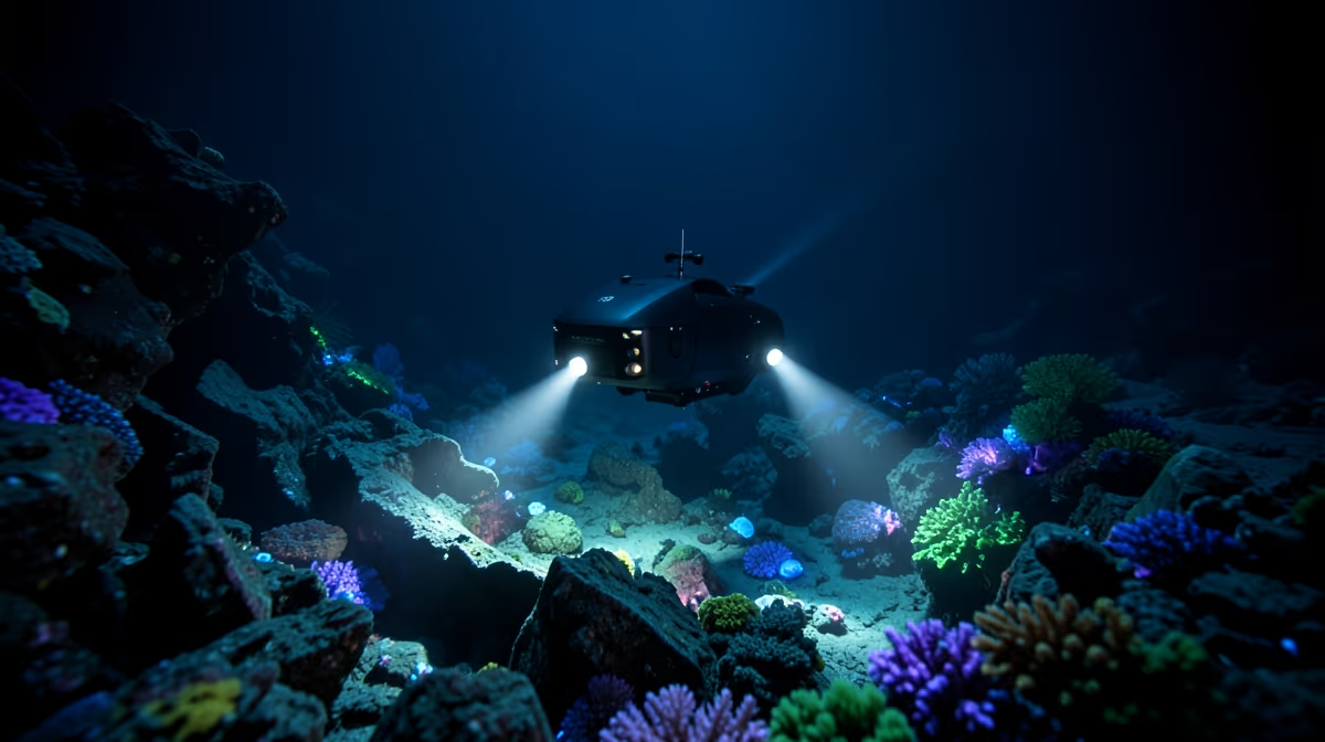
The Bureau of Ocean Energy Management announced on Tuesday a sweeping federal initiative off the coast of Southern California to map and assess deep-sea ecosystems, aiming to balance offshore renewable energy development with marine conservation. As commercial interest in seabed mining accelerates, policymakers face mounting pressure to balance economic gains with environmental protection. This comprehensive seabed survey will deploy advanced autonomous underwater vehicles to map geological formations and biological habitats across thousands of square miles of the outer continental shelf. Officials stated the data is critical for identifying vulnerable benthic communities, including deep-sea coral reefs and sponge gardens, prior to issuing commercial leases for floating offshore wind turbines. Environmental groups have cautiously welcomed the initiative, emphasizing that the rapid expansion of green energy infrastructure must not come at the expense of unexplored marine environments. The Pacific seabed remains largely underdocumented, and researchers expect the high-resolution sonar and photographic imaging to reveal previously unknown species and geological hazards. Funding for the multi-year project is derived from the federal Bipartisan Infrastructure Law, reflecting a growing national priority to modernize maritime spatial planning. Data collected during the surveys will be made publicly available to academic researchers, commercial developers, and state agencies to inform future regulatory decisions. Mapping the seabed with this level of precision is unprecedented for our Pacific waters and will serve as the foundation for sustainable ocean management, said Dr. Elizabeth Harrison, lead marine ecologist at the National Oceanic and Atmospheric Administration.
The Current State of Deep Sea Exploration
Recent discoveries and regulatory decisions off the coast of the United States have brought the seabed, the bottom of the ocean, into the national spotlight. Scientists and policymakers are looking closely at these deep-water areas, which cover vast stretches of the submerged U.S. territory, to understand what resources lie hidden beneath the mud and rock. At the center of the attention is the potential for harvesting valuable minerals, such as rare earth metals, that are critical for modern technology like electric car batteries and smartphones. However, exploring and potentially mining the ocean floor has sparked intense debates about how this activity might disrupt delicate and largely unknown marine ecosystems. The U.S. seabed covers an immense area of the outer continental shelf, stretching far beyond coastal waters. The ocean floor contains rich deposits of polymetallic nodules, which are packed with critical minerals like nickel, cobalt, and copper. Deep-sea environments host unique, fragile ecosystems that scientists are only beginning to understand. Federal agencies and international bodies are currently debating the rules and environmental safeguards for deep-sea exploration. Advanced robotics and sonar technology are allowing researchers to map the U.S. seabed in unprecedented detail. For centuries, the seabed was largely viewed as a barren underwater desert of interest only to marine biologists and cable-laying companies. In recent decades, rising global demand for technology minerals and advances in deep-sea robotics have transformed the ocean floor from a remote frontier into a potential new zone for resource extraction.
Navigating Complex Maritime Jurisdiction Laws
The race to secure critical mineral supply chains, specifically rare earth elements and polymetallic nodules essential for green technologies and defense systems, combines with legal ambiguities in the UN Convention on the Law of the Sea. A high-stakes bipartisan push in Washington to counter Chinese dominance in critical mineral processing is compounded by tensions between federal agencies rushing to permit extraction and coastal states demanding environmental sovereignty. Unlocking trillions of dollars in untapped underwater mineral wealth simultaneously threatens traditional maritime industries, coastal tourism, and commercial fisheries with irreversible benthic disruption. This dynamic creates a new oceanic theater for great power competition, where control over deep-sea ridges and fracture zones dictates technological hegemony and supply chain resilience for the next century. Beneath commercial mining claims lies the intense militarization of the seabed, where undersea internet cables, acoustic surveillance arrays, and unacknowledged naval defense infrastructure intersect. Historically, this mirrors the nineteenth-century Guano Islands Act and the deep-sea manganese nodule craze of the 1970s, where geopolitical anxiety over resource scarcity drove unilateral territorial claims on international commons. The international framework has evolved through key milestones, starting in 1982 when UNCLOS was adopted, establishing the International Seabed Authority but leaving the United States as a non-signatory, creating long-term jurisdictional friction. In 2021, Nauru triggered the two-year rule under the International Seabed Authority, forcing the international community to urgently consider commercial deep-sea mining exploitation regulations. By 2023, the Department of Defense and Congress stepped up pressure to secure domestic seabed resources and protect critical undersea infrastructure from foreign espionage. Now, the United States navigates a dual crisis of accelerating domestic seabed permitting for critical minerals while attempting to deter foreign adversaries from weaponizing oceanic choke points.
Why This Matters
How we manage the seabed will shape the future of the global clean energy transition and the health of our oceans. Sourcing minerals from the ocean floor could reduce dependence on land-based mines with poor human rights records, but it risks causing irreversible damage to deep-sea habitats that play a vital role in global climate regulation and marine biodiversity. This issue directly affects coastal communities, commercial fishing industries, renewable energy manufacturers, indigenous groups, and conservationists. In the immediate term, federal agencies will issue initial assessments following recent maritime boundary and deep-sea mineral rights discussions. Within seventy-two hours, stakeholders in the United States offshore energy and environmental sectors will review regulatory frameworks regarding seabed mining and cable protection. Key players involved in these developments include the Department of the Interior, the National Oceanic and Atmospheric Administration, and the Offshore Energy Industry Association, all operating within the realms of offshore energy regulation and marine environmental conservation. Expert prediction indicates that increased scrutiny on deep-seabed mineral exploration and critical undersea infrastructure protection will lead to tighter interagency coordination. The best case scenario involves balanced policy frameworks emerging that protect marine ecosystems while securing critical mineral supply chains, whereas the worst case involves jurisdictional gridlock that delays critical infrastructure maintenance and exacerbates resource access disputes.
Frequently Asked Questions
What is the seabed?
The seabed refers to the solid surface that forms the bottom of the ocean, sea, or other large body of water. It encompasses diverse geological features, including vast abyssal plains, deep ocean trenches, and underwater mountain ranges known as mid-ocean ridges. This dynamic environment covers over 70 percent of the Earth's surface.
What are the main zones of the seabed?
The seabed is generally divided into several vertical and horizontal zones based on depth and light penetration. These include the continental shelf, the continental slope, the abyssal plain, and the deepest hadal zone found in ocean trenches. Each zone hosts unique geological formations and specialized marine ecosystems adapted to extreme pressures and temperatures.
How deep is the seabed on average?
The average depth of the ocean seabed is approximately 12,100 feet or 3,700 meters below the surface. However, the depth varies dramatically across different regions, ranging from shallow coastal shelves just a few feet deep to the Challenger Deep in the Mariana Trench, which plunges nearly 36,000 feet down.
What lives on the seabed?
A surprisingly diverse array of organisms inhabits the seabed, ranging from microscopic bacteria to complex invertebrates like crabs, sea stars, and giant tube worms. In the deep zones where sunlight cannot reach, many creatures rely on chemosynthesis around hydrothermal vents rather than photosynthesis. Coral reefs also form massive living structures on shallower parts of the seabed.
How is the seabed mapped?
Scientists primarily map the seabed using advanced sonar technology, including multibeam echosounders mounted on research vessels. Satellite altimetry is also used to measure subtle variations in the ocean surface's height, which correspond to underwater gravitational pulls from massive seabed features. Despite these technologies, a vast majority of the deep seafloor remains unexplored and unmapped.
Why is exploring the seabed important?
Exploring the seabed is crucial for understanding Earth's plate tectonics, ocean circulation patterns, and global climate regulation. It also helps scientists discover new marine species, assess potential risks from underwater earthquakes and tsunamis, and evaluate mineral resources. Gaining this knowledge is essential for effective marine conservation and sustainable management of ocean resources.
Conclusion
Federal funding has been officially allocated for offshore mapping initiatives, and initial deployment of autonomous survey vessels has begun off the Southern California coast under the leadership of the Bureau of Ocean Energy Management. While the full scope of environmental impact assessments and the exact timeline for future commercial offshore wind lease sales remain under active review, the Bureau of Ocean Energy Management leads the offshore mapping initiative with funding provided through the federal Bipartisan Infrastructure Law. Stakeholders across federal agencies, environmental organizations, and commercial sectors will continue reviewing regulatory frameworks as initial assessments are issued and interagency coordination tightens around maritime boundary and deep-sea mineral rights discussions.


.webp)
