
Flash Flood Warning Triggers Emergency Rescues Across US Regions
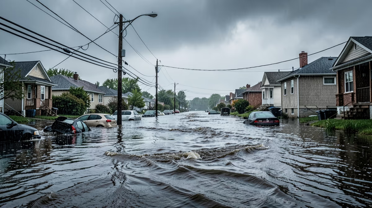
The National Weather Service issued a rare flash flood emergency for parts of the mid-Atlantic on Thursday morning, following torrential downpours that dropped up to six inches of rain in less than two hours, trapping motorists and threatening residential areas. A flash flood warning has been issued for several regions as severe storms bring torrential downpours, marking another critical test for vulnerable communities grappling with extreme weather events. The sudden deluge began just before dawn, rapidly overwhelming storm drainage systems in urban and suburban centers. Local emergency management agencies reported dozens of water rescues within the first hour of the warning, as rising waters quickly submerged major roadways and residential streets.
What Unfolded
First responders have prioritized swift-water rescue operations, utilizing specialized boats to reach residents trapped in homes and vehicles. Power outages have also affected thousands of customers as substations experienced localized flooding. Transportation officials have closed multiple major highway corridors and suspended local commuter rail lines indefinitely. Authorities strongly urge residents in low-lying areas to evacuate immediately to higher ground and to avoid driving through standing water.
This is a life-threatening situation. Do not attempt to travel unless you are fleeing an area subject to flooding or under an evacuation order, said Sarah Jenkins, a meteorologist with the National Weather Service forecast office. Heavy rainfall continues to cause rapid runoff, leading to life-threatening flash flooding in low-lying areas, urban centers, and near small streams. Emergency services will conduct swift-water rescues and issue mandatory evacuations for severely affected zones over the next 24 hours.
Understanding Severe Weather: From Heat Index to Tornadoes
A flash flood warning means that dangerous flooding is happening right now or is about to happen very soon. This is usually caused by heavy, sudden rainfall that the ground cannot absorb fast enough, turning normally dry streets and streams into rushing rivers. Water can rise rapidly in just a few minutes, catching people completely off guard. Even a small amount of moving water can be extremely powerful and sweep away cars or knock adults off their feet, making it a very hazardous situation for anyone in the path of the water.
Flash floods are one of the deadliest weather-related hazards because they happen so quickly. Driving or walking through floodwaters puts lives at immediate risk, while homes and businesses can suffer catastrophic water damage in a matter of minutes, destroying property and cutting off evacuation routes. Residents living in low-lying areas, near rivers and streams, in urban environments with poor drainage, and anyone traveling on roads currently covered by water are most affected. Flash floods are a frequent weather hazard across the United States, often triggered by slow-moving thunderstorms, hurricanes, or heavy seasonal rains. Climate patterns and the expansion of paved urban areas have made many communities more vulnerable to sudden, intense flooding events.
Structural Vulnerabilities and Root Causes
The severity of these events is underpinned by decades of deferred investment in aging stormwater infrastructure coupled with rapid, poorly regulated urban sprawl that seals natural permeable earth with asphalt. This mirrors historical parallels such as the catastrophic flooding of the Midwest in 1993, which exposed the failure of a purely reactive, engineering-heavy approach to water management.
This infrastructure deficit intersects with political challenges, marked by partisan gridlock over federal climate adaptation funding and local zoning battles between real estate developers and environmental protection advocates. Economically, these dynamics result in massive localized property devaluation, catastrophic supply chain disruptions, soaring municipal debt from emergency repairs, and skyrocketing flood insurance premiums. Furthermore, the crisis highlights a hidden angle: the disproportionate impact on marginalized communities lacking green spaces and adequate drainage, turning climate vulnerability into systemic environmental injustice. Geopolitically, domestic vulnerability to climate shocks strains federal disaster relief budgets and diverts strategic focus.
Essential Safety Measures During Major Flooding
Managing the immediate threat requires strict adherence to emergency guidance. Flash flood warnings require immediate action to ensure safety, and flooding can happen within minutes of heavy rainfall. Most flood-related deaths occur in vehicles, making restraint and avoidance critical. Urban areas with a lot of concrete and asphalt are especially prone to fast-rising water, and nighttime flooding is particularly dangerous because hazards are harder to see.
Meteorologists anticipate the intense convective storm system to progress eastward, leaving behind saturated soils that will heighten vulnerability to subsequent rainfall over the coming week. In the best-case scenario, storm systems weaken faster than anticipated, resulting in minimal structural damage, swift recession of floodwaters, and zero casualties. Conversely, the worst-case scenario involves persistent training storms dumping unprecedented rainfall totals, causing catastrophic dam or levee overtopping, widespread structural collapse, and prolonged power outages. Waters will begin to recede as precipitation moves out of the region within 72 hours, transitioning warnings from flash floods to broader river flood warnings while damage assessments, infrastructure repair, and cleanup operations commence.
Frequently Asked Questions
What does a flash flood warning mean?
A flash flood warning indicates that flash flooding is imminent or already occurring in the specified area. You should take immediate safety precautions, such as moving to higher ground, as these floods develop quickly within minutes or hours.
What should you do during a flash flood warning?
Immediately move away from low-lying areas, streams, drainage ditches, and canyons. If you are driving, never attempt to cross flooded roadways, as just six inches of fast-moving water can sweep a vehicle away.
What is the difference between a flash flood watch and a warning?
A watch means that flash flooding is possible in and close to the designated area due to favorable weather conditions. A warning means that a flash flood is already happening or will happen very soon, requiring urgent action.
How long does a flash flood warning typically last?
Most flash flood warnings are issued for a duration of several hours, usually between two to six hours depending on the storm system. However, authorities may extend the warning if heavy rainfall continues to impact the region.
Can a flash flood happen without rain?
Yes, flash floods can occur without any local rainfall, especially in mountainous or canyon regions. Heavy rain miles away can travel down riverbeds and narrow canyons as a wall of water, surprising unsuspecting hikers.
How do I receive flash flood warnings on my phone?
Flash flood warnings are automatically sent to mobile devices via the Emergency Alert System (EAS) and Wireless Emergency Alerts (WEA). You can also download reliable weather apps or use a NOAA Weather Radio for real-time alerts.
Conclusion
The National Weather Service confirmed that up to six inches of rain fell in under two hours, prompting a flash flood emergency, widespread roadway and rail closures, and active swift-water rescues by first responders. As heavy precipitation moves out of the affected region over the next 72 hours, waters are expected to recede and transition into broader river flood warnings. Emergency management agencies, first responders, and local authorities will shift their focus from active rescues to comprehensive damage assessments, infrastructure repairs, and community cleanup operations while monitoring saturated soils for subsequent weather risks.


.webp)

