
Flood Situation Near Mahanadi River Reaches Critical Levels As Rains Surge
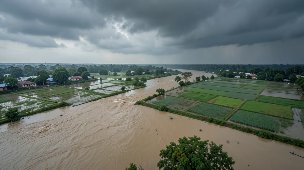
As upstream monsoon downpours swell the major river basins of eastern India, the flood situation near mahanadi river remains critical as authorities monitor rising water levels and potential overflow risks across affected districts in Odisha. Continuous and heavy rainfall across the upper catchment areas of neighboring Chhattisgarh has sent massive volumes of water surging downstream, testing the structural capacities of regional reservoirs and forcing state disaster management authorities into a state of high alert.
Current Mahanadi River Water Level and Dam Status
Continuous downpours in the upper catchment areas of Chhattisgarh have significantly swollen the Mahanadi River, prompting the Hirakud Dam administration to open several sluice gates to release excess water safely. As water levels breached critical marks at key points, district administrations initiated preemptive evacuations for vulnerable communities residing in the deltaic region. Water Resources Department officials stated that they are closely monitoring the inflow and outflow rates at the Hirakud Reservoir to ensure downstream safety while preventing sudden catastrophic flooding, noting that all district collectors have been instructed to maintain round-the-clock vigilance. Real-time water levels of the river fluctuate depending on heavy monsoon rainfall and massive water releases, with low-lying areas in districts like Cuttack and Puri frequently facing inundation during peak monsoon periods. Official portals managed by the Central Water Commission and the Odisha state water resources department provide live data on gauge readings at key sites like the Mundali barrage and Hirakud Dam.
Impact of Heavy Rains on Odisha Flood Situation
The sudden surge in river volume has triggered widespread impacts across the vulnerable deltaic plains. Agricultural fields near the riverbanks have suffered extensive inundation, raising serious concerns over crop damage among local farmers who face the destruction of standing harvests just before seasonal collection periods. Transportation links in some rural pockets have also been temporarily disrupted due to overflowing rainwater submerging local approach roads and minor bridges. This sudden flooding poses an immediate threat to human life, livestock, and property, while disruptions to clean water supplies and electricity increase the risk of waterborne diseases and long-term economic hardship for vulnerable rural communities. Farmers, villagers, and daily wage workers living in low-lying areas and flood plains along the basin are bearing the brunt of these conditions, confronting the immediate destruction of paddy yields and recurring fiscal strain on state resources.
Government Relief Measures and Evacuation Updates
State disaster response teams, including the Odisha Disaster Rapid Action Force and the National Disaster Response Force, have been pre-positioned in high-risk zones across districts such as Cuttack, Puri, Jagatsinghpur, and Kendrapada. Relief camps are currently being set up with provisions for drinking water, dry rations, and medical supplies to accommodate the displaced populations. Temporary flood shelters have been established on elevated grounds to support families evacuated from submerged areas. During severe flooding, disaster response forces are deployed for rescue operations, and authorities issue early warnings to evacuate vulnerable settlements in advance. Officials continue to urge people living near riverbanks to move to higher ground immediately while emergency operation centers broadcast regular safety updates.
Systemic Drivers and Environmental Pressures
Underlying structural vulnerabilities compound the seasonal challenges faced by the region. The root causes of severe flooding include deforestation in the upper catchment areas combined with sedimentation and the structural incapacity of the Hirakud Dam to manage extreme monsoonal cloudbursts. Furthermore, unregulated sand mining along the riverbed has severely altered natural drainage morphology, worsening localized flash flooding. These environmental pressures echo historical events such as the catastrophic 1937 Mahanadi floods that prompted the initial conceptualization of the Hirakud Dam project. The situation also touches upon broader regional dynamics, including internal climate migration and resource competition within eastern India, which indirectly strain national food security buffers and test institutional preparedness frameworks.
Next 24 to 72 Hours Outlook
Looking ahead, the immediate operational focus centers on continued water level monitoring at the Hirakud Dam and the controlled release of floodwaters through sluice gates as upstream inflows remain high due to ongoing monsoon rains. Over the next 72 hours, there is a distinct potential for localized flooding in low-lying delta regions as upstream water travels downstream, affecting agriculture and rural habitations. Expert prediction models indicate that water levels are expected to remain near or slightly above warning levels for the next two to three days, necessitating continued vigilance but avoiding catastrophic breaches if controlled discharges are managed effectively. Under the best-case scenario, monsoon intensity decreases upstream, allowing dam authorities to gradually reduce water release without causing overflow or significant damage to crops and infrastructure. Conversely, the worst-case scenario involves heavy unpredicted rainfall in upper catchment areas forcing sudden emergency releases from the dam, leading to severe riverine flooding and extensive displacement in the Mahanadi delta.
Frequently Asked Questions
What is the current flood situation in the Mahanadi river basin?
The flood situation in the Mahanadi river basin is closely monitored by the Central Water Commission and local authorities. Water levels fluctuate depending on heavy monsoon rainfall and massive water releases from the Hirakud Dam. Low-lying areas in districts like Cuttack and Puri often face inundation during peak monsoon periods.
How does the Hirakud Dam affect flooding along the Mahanadi river?
The Hirakud Dam plays a crucial role in regulating water flow downstream into the Mahanadi river. During heavy upstream rainfall, excess water must be released through spillway gates to protect the dam's structural integrity. This controlled release frequently causes rising water levels and localized flooding in downstream delta regions.
Which districts in Odisha are most vulnerable to Mahanadi river floods?
Districts located in the Mahanadi river delta and lower basin are the most vulnerable to flooding. Areas such as Cuttack, Kendrapara, Jagatsinghpur, Puri, and Sambalpur experience recurring inundation. Local administrations frequently deploy disaster response teams to these zones during heavy rains.
What causes frequent flooding in the Mahanadi river?
Frequent flooding in the Mahanadi river is primarily caused by intense monsoon downpours in the upper catchment areas of Chhattisgarh and Odisha. Siltation in the riverbed has also reduced its carrying capacity over the years. Additionally, simultaneous heavy rainfall in tributary rivers exacerbates the overflow.
What relief measures are taken during Mahanadi floods?
During severe flooding, state and national disaster response forces (NDRF and ODRF) are deployed for rescue and relief operations. Temporary flood shelters are set up on elevated grounds with provisions for dry food, drinking water, and medical aid. Authorities also issue early warnings to evacuate vulnerable settlements in advance.
Where can I check real-time water levels of the Mahanadi river?
Real-time water levels of the Mahanadi river can be checked through official portals managed by the Central Water Commission (CWC) and the Odisha state water resources department. These platforms provide live data on gauge readings at key sites like the Mundali barrage and Hirakud Dam. Local news channels and district emergency operation centers also broadcast regular updates.
Conclusion
The unfolding flood event along the Mahanadi River basin highlights the complex interplay between intense monsoon weather patterns, upstream catchment management, and deltaic vulnerability in eastern India. With confirmed controlled water releases from the Hirakud Dam and active evacuations managed by disaster response teams in districts such as Cuttack and Kendrapara, authorities remain focused on safeguarding human lives and mitigating infrastructural damage. While agricultural assessments and long-term relief operations continue to develop as water levels fluctuate, ongoing vigilance and coordinated multi-agency monitoring remain essential to navigating the remaining monsoon risks in the days ahead.


.webp)

