
Super El Nino Winter Weather Unveils Extreme Shifts Across the US
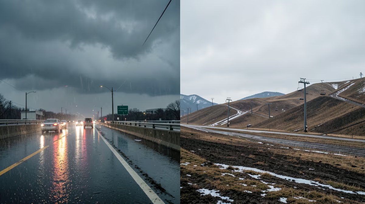
Federal meteorologists confirmed today that a historically strong Super El Nino is actively reshaping the United States winter weather patterns, driving record-breaking warmth across the northern tier and threatening severe, moisture-laden storms throughout the southern states. As meteorologists track shifting climate patterns, super el nino winter weather is dominating discussions about the upcoming season. This natural climate phenomenon is acting as a massive steering wheel in the atmosphere, shifting the jet stream far south of its normal position and setting the stage for a deeply divided North American winter map.
Understanding the Phenomenon and Root Causes
A powerful Super El Nino is officially underway in the Pacific Ocean, driven by anomalous warming of sea surface temperatures in the central and eastern equatorial Pacific Ocean, combining with long-term climate change baselines to supercharge atmospheric river formations and disrupt the stratospheric polar vortex. El Nino is a natural climate pattern where waters near the equator become much warmer than usual. When it reaches super status, it fundamentally alters atmospheric circulation. The Climate Prediction Center reports that sea surface temperatures in the equatorial Pacific Ocean have surpassed thresholds seen during the historic El Nino events of 1997-1998 and 2015-2016. This massive pool of warm water persistently alters the jet stream, pushing it further north over the continent and creating a meteorological divide. Michelle L'Heureux, lead El Nino forecaster at the Climate Prediction Center, noted that this event is currently ranking among the strongest on record, with its fingerprints clearly visible across the current weather map.
What Winter Weather 2026 Forecasts Predict for Your Region
The resulting meteorological divide creates vastly contrasting regional experiences. In the Pacific Northwest and the Upper Midwest, the shifted jet stream has resulted in unusually mild temperatures and significantly below-average snowpack, raising early concerns about summer water supplies and agricultural irrigation. Conversely, the southern United States, particularly California, the Gulf Coast, and Florida, is experiencing an active storm track characterized by persistent atmospheric rivers and heavy rainfall. The northern tier of the country is predicted to be noticeably warmer and drier than average, while the southern half of the U.S. is gearing up for a wetter and stormier season fueled by a steady stream of moisture coming off the ocean. Ski resorts in the northern Rockies and New England are increasingly reliant on snowmaking technology as natural snowfall remains sparse, while emergency management agencies across the southern tier have ramped up preparedness efforts, anticipating flash flooding, mudslides, and severe coastal erosion over the coming months.
Immediate Operational Responses and Market Reactions
Emergency management agencies and economic sectors are already moving to counter the forecasted volatility. Meteorological agencies have issued updated winter outlooks highlighting persistent tropical Pacific warmth and shifting jet stream patterns, which quickly triggered responses across national infrastructure. Energy markets and municipal emergency services began prepositioning resources and reviewing contingency plans for a volatile winter storm season. Key federal and regional players, including the NOAA Climate Prediction Center, the National Weather Service, FEMA, and major U.S. energy utilities, are coordinating early advisories. Severe supply chain bottlenecks along agricultural transport corridors and massive spikes in natural gas price volatility due to erratic heating demand are central concerns for analysts, alongside billions in infrastructure damage concentrated in the Pacific Northwest and California. Furthermore, disaster relief funding negotiations are becoming hyper-partisan battlegrounds, with climate-vulnerable regions competing for FEMA allocation while federal lawmakers weaponize emergency aid bills.
Evaluating the Best Case and Worst Case Scenarios
Forecasters anticipate a strong Super El Nino will supercharge the southern jet stream, bringing above-average precipitation to the southern tier and milder, drier conditions to the northern US. In the best-case scenario, gentle, moisture-rich storms alleviate drought conditions in the West and refill reservoirs without causing catastrophic flash flooding or mudslides. However, the worst-case scenario involves a relentless succession of atmospheric rivers triggering catastrophic flooding and landslides in California, paired with severe ice storms in the Northeast. US agricultural export shortfalls to Asia and Latin America could destabilize global food security indexes, forcing diplomatic realignments as Washington increases reliance on foreign grain reserves. Additionally, sudden flooding often fails to replenish depleted water tables due to rapid runoff over drought-baked soil, placing severe strain on aging domestic water infrastructure and subterranean aquifers.
Frequently Asked Questions
What is a super El Nino and how does it affect US winter weather?
A super El Nino occurs when sea surface temperatures in the central and eastern tropical Pacific rise significantly above average. This strong warming shifts the jet stream further south, heavily influencing winter temperature and precipitation patterns across the United States.
How does a super El Nino impact winter temperatures in the US?
During a super El Nino winter, the northern tier of the US, including the Pacific Northwest and the Upper Midwest, typically experiences warmer-than-average temperatures. Conversely, the southern states and parts of the Southwest often see cooler and wetter conditions due to increased cloud cover and storm activity.
Will a super El Nino bring more snow to the US?
Snowfall varies greatly by region during a super El Nino winter. Cities in the Northeast and Midwest generally experience below-average snowfall due to milder temperatures, while the Southern Plains, Gulf Coast, and parts of the West can receive above-average winter precipitation and occasional heavy snowfall.
Which US regions get the most rain during a super El Nino winter?
The southern United States, stretching from California across Texas and into the Southeast, usually receives significantly more rainfall during a super El Nino. This heightened storm track can sometimes lead to localized flooding, mudslides in saturated areas, and drought relief for the region.
How does super El Nino affect the Northeast US winter?
The Northeast typically experiences a milder and less snowy winter during a super El Nino phase. The dominant jet stream position tends to block cold Arctic air masses from plunging deeply into the region, resulting in fewer major nor'easters and more mixed precipitation events.
Does a super El Nino guarantee a warm winter everywhere in the US?
No, a super El Nino does not guarantee a warm winter across the entire country, though it does heavily tip the odds in that direction for northern states. Localized weather patterns, the Arctic Oscillation, and sudden stratospheric warmings can still disrupt the typical El Nino pattern and bring bouts of severe cold.
Conclusion
The arrival of a historically potent Super El Nino underscores the profound influence of Pacific Ocean dynamics on North American climate patterns. With equatorial sea surface temperatures holding at record highs, confirmed meteorological shifts are actively driving warm, dry conditions across the northern tier while priming the southern U.S. for an active, moisture-heavy storm track. As federal agencies, emergency responders, and regional stakeholders monitor the precise development of atmospheric rivers and regional temperature divides, preparedness remains the primary defense against both localized flooding risks and agricultural water deficits. Realistic next steps involve continuous tracking of dynamic storm systems by the National Weather Service and coordinated resource deployment by emergency management teams through the peak winter months.


.webp)

