
Category 5 Hurricane Polo Shatters Records in the Eastern Pacific
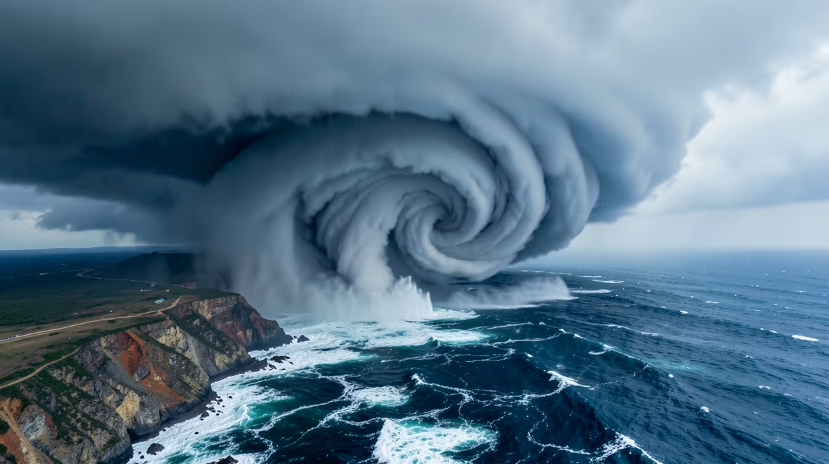
The rapid metamorphosis of a tropical system into a historic titan has left meteorologists scrambling to recalibrate their understanding of Pacific storm dynamics. The Eastern Pacific has witnessed an unprecedented weather event as Category 5 Hurricane Polo developed with historic intensity, threatening coastal regions with a ferocity rarely documented in modern records. Within a matter of hours, the system transitioned from a dangerous cyclone into a meteorological anomaly, commanding the attention of global intelligence agencies and environmental scientists alike. As the storm maintains its peak strength just off the Mexican coastline, the implications for regional safety and climate science continue to escalate.
The historic intensity of Hurricane Polo highlights the growing unpredictability and severity of extreme weather events under current Pacific climate patterns.
The Meteorological Surge of Hurricane Polo
Hurricane Polo has exploded into a historic Category 5 storm off the coast of Mexico, ranking as one of the most intense tropical cyclones ever recorded in the eastern Pacific. This exceptional development was not a gradual buildup but a sudden surge that has placed the Pacific Ocean under siege. Tracking maps and real-time satellite data indicate that the system holds its ground just off the coastline, maintaining the absolute maximum rating on the Saffir-Simpson hurricane wind scale.
Meteorological agencies, including those cited by the San Francisco Chronicle and NPR, have identified Polo as the second-most intense storm on record for the basin. The storm's rapid intensification—a process where a hurricane's wind speeds increase significantly in a short window—has stunned forecasters. As it stands, Polo represents the highest level of storm severity, capable of producing catastrophic destruction through high winds, heavy rainfall, and life-threatening storm surges.
| Date | Meteorological Milestone |
|---|---|
| September 22, 2026 | Hurricane Polo rapidly explodes into a Category 5 storm off the coast of Mexico. |
| September 23, 2026 | Storm maintains historic intensity, recognized as the eastern Pacific's second-most intense storm. |
| September 23, 2026 | El Niño-driven tropical cyclone activity places the Pacific Ocean under siege. |
Rapid Intensification and Satellite Tracking
The system’s explosive growth is linked to an unusually active environment in the Pacific Ocean. Monitoring efforts by The New York Times and earthsky.org have utilized real-time mapping to track the storm's trajectory as it commands the region. Authorities are focusing on the system’s sustained threat near land, where it holds Category 5 strength, making it one of the strongest storms ever recorded in these waters.
The Role of El Niño and Ocean Heat Content
The root cause of this historic intensity is attributed to unprecedented ocean heat content fueled by strong El Niño conditions in the eastern Pacific. This atmospheric and oceanic phenomenon has created a "wild" Pacific environment, providing the thermal energy necessary for such rapid intensification. El Niño cycles are known to alter weather patterns significantly, but the current phase has created conditions that favor the formation of exceptionally powerful systems like Polo.
The Pacific Ocean is currently experiencing heightened tropical cyclone activity. This active season is characterized by warm ocean surface temperatures that serve as high-octane fuel for developing storms. Meteorologists note that the extreme strengthening of Hurricane Polo is a direct signal of modern extreme weather trends, where the confluence of marine heat and atmospheric conditions leads to systems that exceed historical norms.
A Category 5 hurricane represents the highest level of storm severity, capable of causing catastrophic destruction to coastal infrastructure and widespread power outages.
Regional and Economic Impacts on Mexico
Coastal residents and communities in Mexico along the path of the storm face an immediate and severe threat. The economic angle of this disaster is multifaceted, involving potential long-term disruptions to the western Mexican economy. Beyond the immediate physical danger, the storm poses significant threats to coastal infrastructure, which may face severe structural damage if the storm makes a direct landfall.
- Tourism Revenue: The coastal regions of western Mexico rely heavily on tourism; a storm of this magnitude threatens to halt operations and cause long-term damage to resorts and travel hubs.
- Regional Supply Chains: Maritime industries and regional supply chains operating in the eastern Pacific face significant disruptions as ports and shipping routes are impacted by the storm’s presence.
- Agricultural Disruptions: Heavy rainfall and widespread flooding are expected to affect inland agricultural zones, potentially damaging crops and infrastructure.
Emergency Response and Infrastructure Resilience
Mexican federal and regional authorities are currently facing immense political pressure regarding disaster preparedness. The allocation of emergency response resources along the coast is a priority as authorities assess the risks of coastal flooding and high winds. Disaster management officials are providing continuous tracking updates and safety warnings, emphasizing the need for robust emergency evacuation protocols in vulnerable zones.
Geopolitical and Climate Implications
The amplified climate volatility in the eastern Pacific raises urgent questions about international climate mitigation commitments. As Hurricane Polo sets records, it serves as a catalyst for discussions regarding disaster aid frameworks and cross-border emergency cooperation in North America. The geopolitical angle suggests that as these extreme events become more frequent, the need for coordinated response efforts between nations becomes paramount.
Furthermore, there is a hidden angle involving the compounding strain of back-to-back extreme weather events. Under active El Niño cycles, the repetition of such storms may quietly accelerate long-term demographic shifts. Experts suggest this could drive climate-induced internal migration, as populations move away from vulnerable coastal zones that are increasingly under siege from catastrophic storms.
Historical Parallel: Hurricane Patricia
To understand the magnitude of Hurricane Polo, analysts point to a historical parallel: Hurricane Patricia in 2015. Patricia also achieved historic Category 5 intensity in the eastern Pacific, driven by extreme marine heat during a strong El Niño year. Like Patricia, Polo has utilized the high ocean heat content to reach its record-breaking status. This comparison underscores the recurring threat posed by marine heatwaves and the specific vulnerability of the eastern Pacific basin to rapidly intensifying titans.
Future Outlook: The Next 72 Hours
The immediate future of the region depends on the trajectory of the storm as it holds its strength just offshore. Predictive models and expert analysts provide a range of scenarios for the coming days:
- Next 24 Hours: Hurricane Polo is expected to maintain its dangerous Category 5 strength. Continuous monitoring by meteorological agencies remains the priority as the storm churns near the Mexican coast.
- Next 72 Hours: Regional authorities will focus on tracking the potential path and landfall impacts. Heightened emergency alerts will remain in effect due to the storm’s historic intensity and the ongoing El Niño-driven activity.
Best-Case and Worst-Case Scenarios
In a best-case scenario, the hurricane would weaken rapidly as it moves over cooler waters before making direct landfall. This would significantly reduce the potential for destructive impacts on coastal communities. Conversely, the worst-case scenario involves Hurricane Polo maintaining its historic Category 5 intensity right up to landfall. This would lead to severe structural damage, widespread power outages, and life-threatening floods across the Mexican coast. Meteorologists remain on high alert as they await the storm's next move.
Frequently Asked Questions
What happened with Hurricane Polo in the eastern Pacific?
Hurricane Polo rapidly intensified into an extremely powerful Category 5 storm off the coast of Mexico. The cyclone achieved historic intensity, stunning meteorologists with its explosive growth.
Why is Hurricane Polo considered a historic storm?
The storm reached unprecedented strength, earning its place as one of the strongest tropical systems ever recorded in the eastern Pacific. Specifically, it became the region's second-most intense storm on record.
Who is affected by Category 5 Hurricane Polo?
Coastal regions of Mexico face severe threats as the massive hurricane holds at Category 5 strength just off the shore. Communities in the storm's path are under siege from dangerous tropical cyclone activity linked to active El Niño conditions.
What makes this hurricane season so unusual?
The Pacific Ocean is currently experiencing heightened tropical cyclone activity driven by a wild El Niño phase. This phenomenon provides favorable conditions for storms like Polo to explode into catastrophic categories.
What happens next as Hurricane Polo moves along the coast?
Forecasters and emergency officials are closely tracking the storm's trajectory via maps and satellite data to anticipate landfall or coastal impacts. Residents in vulnerable areas remain on high alert as the powerful system churns near land.
How strong did Hurricane Polo actually get?
Polo reached the absolute maximum rating on the Saffir-Simpson hurricane wind scale as a Category 5 storm. According to reports from outlets like NPR and the San Francisco Chronicle, it stands among the most intense storms in recorded meteorological history for the basin.
Conclusion
Hurricane Polo has established itself as a landmark event in meteorological history, reaching Category 5 intensity and becoming the second-most intense storm ever recorded in the eastern Pacific. Driven by extreme ocean heat and a powerful El Niño cycle, the storm’s rapid intensification highlights a shifting landscape of weather volatility. As regional authorities in Mexico and international meteorological agencies continue to monitor the system, the focus remains on emergency preparedness and coastal safety. Whether the storm weakens before landfall or maintains its historic strength, its development serves as a stark reminder of the power of modern climatic shifts and the urgent need for resilient infrastructure in the face of an increasingly active Pacific.
Sources
- Category 5 Hurricane Polo is 'one of the strongest storms ever' — NPR
- El Niño goes wild: Pacific Ocean under siege from tropical cyclones — USA Today
- Maps: Tracking Hurricane Polo — The New York Times
- Hurricane Polo explodes into a Category 5 storm off Mexico — earthsky.org
- Category 5 Hurricane Polo becomes the eastern Pacific's second-most intense storm on record — San Francisco Chronicle
- Hurricane Polo holds at Category 5 strength just off the coast of Mexico — KBTX News 3


.webp)


