
Disang River Flood Situation Escalates in Assam As Danger Marks Breached
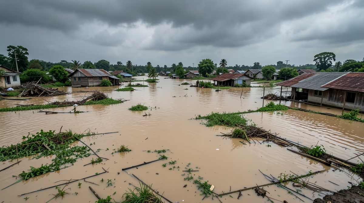
Continuous heavy monsoon rainfall has triggered a severe flood situation along the Disang River in Assam, India, inundating multiple villages and displacing thousands of residents as water levels breached danger marks early Tuesday morning. The current flood situation near disang river has deteriorated rapidly over the past 24 hours, displacing hundreds of families as continuous monsoon rains batter the region. Heavy monsoon rains have caused the Disang River in Assam, India, to swell dangerously over its danger mark, while the overflowing water has breached embankments, spilling into nearby villages and agricultural lands, forcing hundreds of families to flee their homes. Local disaster management teams and rescue boats have been deployed to help stranded residents move to safer high-ground areas and relief camps, though continuous rainfall is making rescue operations difficult as authorities closely monitor water levels.
Current Disang River Water Level and Danger Marks
The overflowing Disang River, a major tributary of the Brahmaputra, has breached embankments in several vulnerable sectors across the Sivasagar and Charaideo districts. Floodwaters have submerged vast tracts of agricultural land, destroying standing crops and cutting off vital road communication networks, leaving several rural communities marooned. The Disang River water level has crossed the danger mark at several key monitoring points following heavy monsoon rains, posing an immediate threat of further bank erosion and flash floods. Water resource departments are issuing timely alerts to residents living nearby, while district administrations step in to assess damages and manage the unfolding crisis.
Impact of Assam Floods on Sivasagar District
The assam floods are severely affecting the Disang river basin, particularly impacting districts in Upper Assam such as Sivasagar and Charaideo. Agricultural lands, rural infrastructure, and residential areas along the riverbanks bear the brunt of the inundation, causing significant financial loss to farmers who rely on seasonal harvests. Water stagnation post-floods often delays subsequent planting cycles as well, threatening the livelihoods of thousands of people. Road connectivity in parts of the affected region has been disrupted, cutting off access to essential supplies like food, clean water, and medical care, making timely intervention crucial to manage the humanitarian crisis.
Relief and Rescue Operations Underway
District administration and the State Disaster Response Force (SDRF) have been deployed to conduct rescue operations and distribute relief materials. Temporary relief camps have been established to shelter displaced families, while medical teams are being mobilized to prevent potential outbreaks of waterborne diseases in the affected zones. According to the District Disaster Management Authority, all necessary resources have been mobilized to ensure the safety of residents in low-lying areas, and rescue boats are actively evacuating stranded populations. Essential supplies, including drinking water, dry rations, and medical aid, are being distributed to those affected in the relief camps.
Systemic Root Causes and Environmental Pressures
Unregulated upper catchment deforestation in the Patkai Range compounded by uncoordinated trans-boundary water management and shifting monsoonal patterns serve as the underlying catalysts for these recurring disasters. Furthermore, the complicity of illegal coal mining and sand dredging in the riverbeds accelerates erosion and drastically reduces the river carrying capacity, worsening the intensity of seasonal inundations. The region experiences severe annual flooding during the monsoon season due to heavy regional rainfall and upstream water flow, echoing historical vulnerabilities seen in past Brahmaputra basin catastrophes.
Outlook and Projected Weather Trajectory
Water levels in the Disang river are expected to remain near or slightly above the danger mark as upstream rainfall persists, prompting continuous monitoring by local authorities. A gradual recession of floodwaters is likely within 72 hours, provided there is a significant reduction in rainfall in the upper catchment areas of Nagaland and Arunachal Pradesh. The flood situation is currently in a critical plateau phase, and while major embankments are holding, prolonged saturation increases the risk of localized breaches if heavy rainfall continues. Engineers remain on high alert around the clock to monitor vulnerable points, balancing best-case scenarios of rapid recession with worst-case risks of embankment breaches and widespread inundation.
Frequently Asked Questions
What is the current flood situation near the Disang River?
The flood situation near the Disang River in Assam remains critical due to incessant rainfall in its upper catchment areas. Continuous downpours have caused the river to breach danger levels, inundating several low-lying villages. Local authorities are closely monitoring water levels and coordinating emergency response efforts.
Which districts are most affected by the Disang River floods?
The floods primarily affect districts in Upper Assam, particularly Sivasagar and Charaideo. Agricultural lands, rural infrastructure, and residential areas along the riverbanks bear the brunt of the inundation. District administrations have stepped in to assess the damage and provide relief to displaced families.
Has the Disang River crossed the danger mark?
Yes, the Disang River has crossed the danger mark at several key monitoring points following heavy monsoon rains. This continuous rise in water levels poses an immediate threat of further bank erosion and flash floods. Water resource departments are issuing timely alerts to residents living nearby.
What relief measures are being taken for flood victims near the Disang River?
The state government, along with the State Disaster Response Force (SDRF), has set up relief camps for displaced populations. Essential supplies, including drinking water, dry rations, and medical aid, are being distributed to those affected. Rescue boats have also been deployed to evacuate people from marooned areas.
How does the Disang River flood impact local agriculture?
Floods from the Disang River severely impact local agriculture by submerging vast tracts of standing paddy and vegetable crops. This causes significant financial loss to farmers who rely on seasonal harvests. Water stagnation post-floods often delays subsequent planting cycles as well.
Where can I check the latest water level updates for the Disang River?
The latest water level updates and flood bulletins can be checked on the official website of the Assam State Disaster Management Authority (ASDMA). Central Water Commission (CWC) portals also provide real-time hydrographs and danger level status for the Disang River. Local news channels and district administration social media handles offer timely ground-level advisories.
Conclusion
The severe flood situation near the Disang River continues to demand an urgent, coordinated humanitarian and administrative response across Upper Assam. With water levels hovering near danger thresholds and rescue operations actively managed by the Assam State Disaster Management Authority, Central Water Commission, and local disaster response teams, authorities remain focused on safeguarding displaced residents and reinforcing vulnerable embankments. As regional stakeholders and researchers evaluate both immediate relief efforts and long-term environmental vulnerabilities, continuous monitoring of upstream weather patterns will dictate the pace of recovery in the coming days.


