
Encino Fire Threatens Southern California as Emergency Efforts Escalate
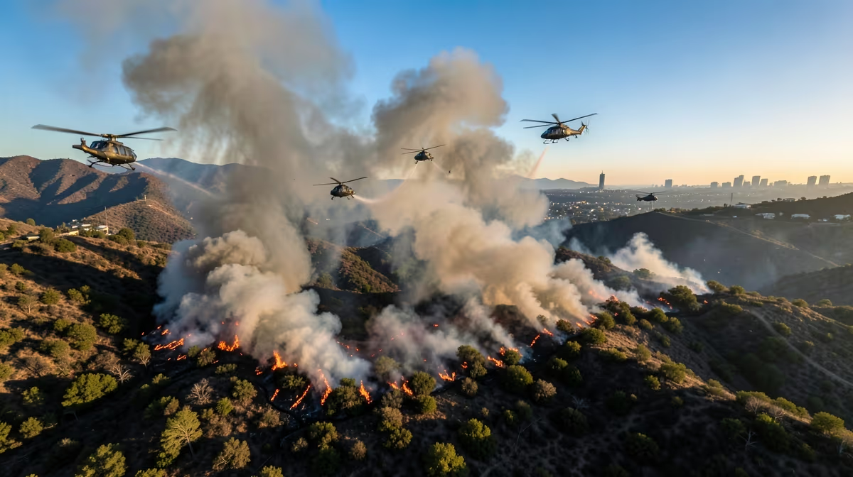
A thin veil of smoke rising over the Santa Monica Mountains signals a recurring crisis for Southern California residents as a brush fire challenges local containment efforts. The latest encino fire has triggered an immediate California emergency response as officials work to contain the blaze, forcing a community to once again grapple with the volatile nature of the wildland-urban interface.
Anatomy of the Blaze
The incident began shortly after 2:00 p.m. PT on Wednesday, when flames were reported in the hilly terrain above the Encino neighborhood. Driven by gusty winds and high temperatures, the fire spread rapidly through dry brush, threatening residential areas nestled against the mountains. The Los Angeles Fire Department quickly mobilized, deploying both ground crews and aerial support to combat the flames. Helicopters have been instrumental in the effort, conducting water drops to suppress the fire in areas inaccessible to fire engines.
Major local roads in the immediate vicinity have been shuttered to ensure the movement of emergency vehicles remains unobstructed. While no large-scale mandatory evacuation orders have been issued for the broader community, residents in select streets remain on high alert. The situation is characterized by shifting wind patterns, which have hampered efforts to establish solid containment lines.
The Mechanics of Risk
Encino sits within the Santa Monica Mountains, a region defined by its steep topography and thick, flammable vegetation known as chaparral. This area is historically prone to seasonal wildfires, where the combination of dry landscapes and Santa Ana wind patterns can turn a minor spark into an urgent disaster. The primary challenges facing responders currently include the difficult terrain and the unpredictability of the wind, which threatens to push the blaze toward residential clusters.
Utility infrastructure is a critical focus for investigators. The root cause of many such fires often lies in the intersection of aging electrical systems, drought-stressed vegetation, and the encroachment of urban development into wildland zones. As the Los Angeles Fire Department continues its defensive posture, utility providers are closely monitoring the grid for signs of damage that could exacerbate the threat.
Economic and Infrastructure Implications
The broader implications of these fires extend well beyond the immediate danger to homes. Southern California faces a compounding crisis characterized by increased insurance premiums and the suppression of local property values. For many, this has led to a significant shift in housing stability. As these corridors become increasingly expensive to insure and maintain, there is a mounting economic pressure on multi-generational households, often forcing the displacement of local workforces.
From a regulatory perspective, there is growing tension between municipal zoning authorities and state bodies. The debate centers on who bears the liability for grid maintenance and the massive capital expenditure required to underground power lines in fire-prone regions. This is not a new dilemma, as the 2017 Thomas Fire previously highlighted the systemic vulnerabilities within regional power distribution grids.
Predicting the Next Phase
Firefighters will focus on containment lines and mop-up operations over the next 24 hours to address remaining hot spots. Residents may receive updates regarding structure inspections as authorities clear affected areas. Within 72 hours, officials expect containment levels to rise as weather conditions stabilize. Once the fire is contained, damage assessment teams will begin surveying properties, and insurance adjusters will arrive on-site to assist homeowners.
Expert projections suggest the fire will reach 80-90% containment within three days, provided that Santa Ana wind gusts remain within projected low-to-moderate ranges. In a best-case scenario, full containment is achieved with minimal additional property loss. However, the worst-case scenario involves unexpected wind shifts leading to spot fires across established containment lines, which would necessitate expanded evacuation orders and threaten a larger number of residential clusters.
The Global Context
The recurring nature of the Encino fire is drawing scrutiny from international observers. Global environmental policies are increasingly being influenced by how Western regions manage their wildfire risk, particularly as these events serve as a case study for climate-linked infrastructure vulnerabilities. The situation in the San Fernando Valley is being watched by policy analysts who are interested in how municipal governments balance the need for development with the existential threat posed by a changing climate.
As this fire highlights the ongoing danger of wildfire season, it serves as a stark reminder of the need for communities to rethink their emergency preparedness. The disproportionate impact on high-cost, fire-prone corridors is forcing a national conversation about the long-term viability of living in the wildland-urban interface.
Frequently Asked Questions
Is there a fire in Encino right now?
To check for active fires in Encino, you should consult real-time resources like the PulsePoint app or the official LAFD alerts page. Local news outlets also provide up-to-date tracking on active brush fires in the San Fernando Valley region.
What caused the recent Encino fire?
The cause depends on the specific incident being referenced, as fires in the area are often attributed to power lines, dry brush conditions, or human activity. For the most accurate cause determination, you must refer to the official investigative report released by the Los Angeles Fire Department after the scene is processed.
Are there mandatory evacuations for the Encino fire?
Mandatory evacuation orders are determined by local authorities based on the fire's progression and wind direction. You can confirm current evacuation status by checking the official LAFD social media channels or visiting the Los Angeles County emergency website for designated zones.
How can I check fire danger levels in Encino?
Fire danger levels in Encino are monitored by the National Weather Service and the Los Angeles Fire Department, particularly during Red Flag Warning periods. You can track current threat levels through the NWS Los Angeles/Oxnard office website.
Is the Encino fire affecting air quality?
Brush fires in the San Fernando Valley can significantly impact local air quality due to smoke and ash particles. Residents can view current air quality index readings for Encino on platforms like AirNow.gov to determine if it is safe to spend time outdoors.
Where can I find news updates on the Encino fire?
Reliable updates are best found on the official Los Angeles Fire Department alert page and local television news stations. Additionally, following verified emergency service accounts on social media can provide the fastest updates on road closures and containment status.
Conclusion
The fire in the Encino hills remains an active and evolving situation, with Los Angeles Fire Department crews continuing to hold containment lines against challenging terrain and variable winds. While the immediate threat to structures is being managed through aggressive aerial and ground support, the event underscores the persistent vulnerabilities of suburban infrastructure in the San Fernando Valley. Residents are advised to stay informed through official channels as damage assessment and mop-up operations continue over the coming days. The focus remains on achieving full containment and ensuring the safety of all displaced residents.


.webp)

.webp)
