
Colombia Earthquake Strikes Central Region, Shaking Bogota
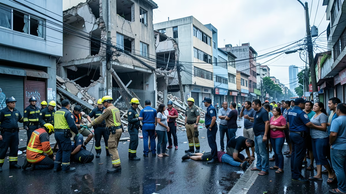
A magnitude 6.0 earthquake struck central Colombia early Friday morning, sending tremors as far away as the capital of Bogota and prompting brief evacuations, though United States Geological Survey and local authorities have reported no immediate widespread damage or casualties. A strong colombia earthquake has struck the region, sending tremors through the capital and prompting immediate safety responses from residents. The seismic event occurred at approximately 6:00 AM local time, with its epicenter located near the municipality of El Calvario in the Meta department, at a depth of roughly 10 kilometers. The shallow nature of the quake caused strong shaking throughout the Andean region, terrifying residents who rushed into the streets during the morning rush hour. Emergency response teams were immediately deployed across Bogota and surrounding departments to assess critical infrastructure, including bridges, dams, and high-rise buildings.
Seismology Data and Epicenter Details
The earthquake originated at a shallow depth of 10 kilometers near El Calvario in the Meta department. Colombia is located in a seismically active region known as the Pacific Ring of Fire, making it prone to frequent earthquakes due to shifting tectonic plates. The country sits atop the convergence of three major tectonic plates, namely the Nazca, South American, and Caribbean plates. Tectonic subduction along the Nazca and South American plates serves as the root cause of these seismic events, a dynamic that is frequently exacerbated by poorly enforced seismic building codes in rural and semi-urban Colombian infrastructure. This specific tectonic rupture generated high-magnitude energy release, causing widespread shaking across the Andean zone and prompting intense scrutiny from seismologists monitoring the aftermath.
Bogota Earthquake Damage Reports and Tremor Intensity
While minor structural damage such as cracked walls and fallen debris has been reported in towns closest to the epicenter, Colombia's National Unit for Disaster Risk Management stated that comprehensive aerial and ground surveys are ongoing. Power grids and water systems in major urban centers remained largely operational, preventing a larger humanitarian crisis in the immediate aftermath. Residents in major cities evacuated buildings as a safety precaution while emergency responders and local authorities actively assessed damages. Checks are being conducted on critical infrastructure like roads, bridges, and hospitals. For residents in the United States with family members in the affected regions, the event triggered widespread anxiety as communication lines temporarily jammed due to heavy volume. Colombian consular offices in the U.S. have established informational channels to assist expatriates seeking updates on loved ones, while international seismological agencies continue to monitor potential aftershocks.
Emergency Response and Operational Outlook
Emergency response teams are currently conducting search and rescue operations, assessing structural damage, and delivering immediate medical aid to affected regions in Colombia. Director General of Colombia's National Unit for Disaster Risk Management noted that comprehensive sweeps of vulnerable zones near the epicenter are underway, emphasizing that while shaking was felt intensely in several departments, early protocols indicate no catastrophic structural failures or loss of life thus far, though citizens must remain vigilant. Over the next 24 to 72 hours, aftershocks are expected to continue, temporary shelters will be established for displaced residents, and international humanitarian aid will begin arriving to support local disaster relief efforts. Seismologists warn of potential moderate aftershocks over the coming days, while economic analysts expect temporary disruptions to regional commerce and infrastructure repair costs. The best-case scenario points to minimal casualties, rapid deployment of government aid, and minor infrastructure damage that is quickly repaired without severely impacting the national economy, whereas the worst-case scenario entails significant loss of life, widespread destruction of critical infrastructure, prolonged isolation of remote mountain communities, and strained emergency response resources.
Socioeconomic and Political Implications
The disaster exposes longstanding regional inequalities, testing the central government's crisis response capabilities and providing opposition factions leverage to critique infrastructure spending and disaster preparedness budgets under President Gustavo Petro. Economically, the event risks short-term spikes in localized inflation and agricultural supply chain disruptions from blocked Andean mountain passes, alongside a significant diversion of national fiscal reserves toward emergency reconstruction rather than structural development. Geopolitically, direct global disruption remains minimal, though the event triggers immediate U.S. humanitarian aid mobilization, reinforcing Washington's soft-power presence and counter-narcotics partnerships in the Andean region. Furthermore, hidden angles involve the severe underreporting of illicit coca lab destruction and environmental destabilization in remote jungle regions caused by earthquake-induced landslides, which temporarily halts eradication efforts and alters local cartel dynamics. This historical parallel echoes the 1999 Armenia, Colombia earthquake, which similarly devastated regional infrastructure and catalyzed decades-long debates over seismic retrofitting and bureaucratic corruption in emergency fund allocation.
Frequently Asked Questions
Was there an earthquake in Colombia recently?
Yes, Colombia experiences frequent seismic activity due to its location on the Pacific Ring of Fire. To check for the most recent events, you should consult official geological monitoring agencies like the USGS or the Colombian Geological Service.
Is it safe to travel to Colombia right now after the earthquake?
In most cases, major tourist destinations and cities remain safe and fully operational following moderate earthquakes. It is always wise to check current travel advisories and local news updates before your departure.
What was the magnitude of the last major earthquake in Colombia?
Earthquake magnitudes vary constantly depending on seismic activity in the region. You can find up-to-date magnitude measurements and epicenter details directly on the United States Geological Survey website.
Why does Colombia have so many earthquakes?
Colombia is located in one of the most seismically active regions in the world known as the Ring of Fire. The country sits atop the convergence of three major tectonic plates: the Nazca, South American, and Caribbean plates.
What should I do if an earthquake hits while I am visiting Colombia?
During shaking, you should immediately drop, cover, and hold on under a sturdy piece of furniture. Stay away from windows and exterior walls, and follow the evacuation instructions of local hotel staff or emergency personnel.
Which regions in Colombia are most prone to earthquakes?
Seismic activity can occur across much of the country, but the Andean region and the Pacific coast experience higher frequencies. Major cities like Bogota, Cali, and Medellin have established building codes to help withstand significant seismic events.
Conclusion
A magnitude 6.0 earthquake struck central Colombia near El Calvario in the Meta department, sending strong tremors through Bogota and surrounding regions without causing immediate widespread casualties or catastrophic structural collapses. Emergency responders, the Colombian Geological Service, the National Unit for Disaster Risk Management, and local municipal governments continue ground and aerial assessments, checking critical infrastructure and managing public safety amid potential aftershocks. As authorities evaluate minor damage in rural and urban zones, emergency protocols remain active to support affected communities and coordinate ongoing disaster relief operations.


