
Colombia Earthquake Strikes Central Region With Sudden 6.0 Magnitude
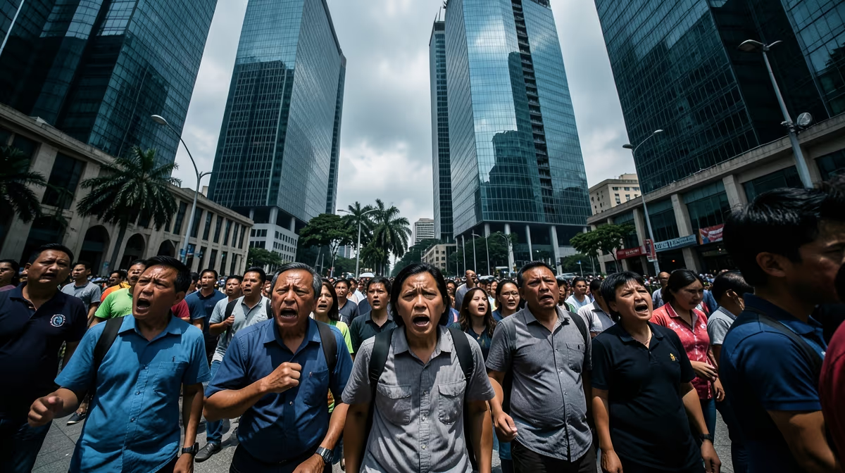
Tectonic stress building deep beneath the Andean mountain range abruptly ruptured, sending violent tremors surging through central Colombia and prompting panic across high-rise districts in the capital. A strong colombia earthquake has struck the region, sending tremors through major cities and causing widespread concern. The seismic event, measuring magnitude 6.0, rattled urban centers and triggered automatic emergency protocols while residents fled swaying office towers and residential blocks into public streets and open plazas. While initial monitoring agencies confirmed no immediate widespread destruction or catastrophic structural collapses in major metropolitan zones, the shallow depth of the tremor guaranteed that millions felt the ground violently churn during midday hours.
Seismic Mechanics and Epicenter Dynamics
The tremor struck at a depth of approximately 10 kilometers, with its epicenter located near the town of El Calvario in the Meta department, roughly 60 kilometers southeast of Bogotá. This shallow depth significantly amplified the shaking felt across multiple regions, translating deep tectonic energy into severe surface motion. Colombia's high earthquake frequency is primarily driven by the subduction of the Nazca Plate beneath the South American Plate, combined with the Caribbean Plate interaction. This geological collision creates immense tectonic pressure along active fault lines, frequently triggering both shallow crustal faults and deeper earthquakes beneath the Andean range where the country sits atop a complex intersection of tectonic plates.
Immediate Urban Response and Citizen Impact
In Bogotá, high-rise office buildings swayed violently for several seconds, triggering automatic evacuation protocols and briefly disrupting the city's mass transit systems. Social media footage captured office workers and students gathering in parks and public plazas as aftershocks rattled the region. Bogotá Mayor Claudia López urged calm via public broadcasts, stating that local authorities had activated all localized emergency protocols and were conducting rapid assessments across all city districts, advising citizens to remain calm and follow instructions from civil defense personnel. Local hospitals and municipal disaster agencies reported an influx of calls regarding panic attacks and minor injuries sustained during hurried evacuations, but no major structural collapses had been officially documented within the first few hours following the primary shock.
Structural Vulnerabilities and Geopolitical Framing
Beyond the urban centers, the disaster exposes longstanding regional inequalities, testing the Petro administration's ability to coordinate disaster relief and weaponizing bureaucratic delays for opposition attacks on regional governance. Tectonic subduction along the Nazca and South American plates is exacerbated by poorly enforced seismic building codes in rural Andean departments. Simultaneously, the United States Southern Command leverages humanitarian assistance and disaster relief frameworks to reinforce strategic influence in the region against growing Chinese infrastructure investments. At the same time, the displacement of vulnerable rural populations accelerates illegal coca crop expansion and informal mining as displaced communities lose traditional agrarian livelihoods, creating secondary systemic pressures that ripple far beyond the initial geological rupture.
Economic Strain and Historical Parallels
The disaster carries immediate financial and operational consequences, including temporary disruption to coffee exports, massive infrastructure strain on the national budget, and redirected foreign aid impacting inflation and fiscal deficit targets. These vulnerabilities evoke memories of the 1999 Armenia, Colombia earthquake, which catalyzed major urban planning reforms but revealed entrenched systemic corruption in reconstruction fund management. National financial systems face immediate auditing as emergency expenditures are authorized to support infrastructure evaluations, transport networks, and critical medical services across the affected departments.
Next 24 To 72 Hours Outlook
Emergency response teams deploy rapidly to affected regions, search and rescue operations commence, and initial damage assessments are broadcasted by national agencies including the Colombian Geological Service, the National Unit for Disaster Risk Management, local municipal authorities, and the Colombian Red Cross. Over the subsequent seventy-two hours, aftershocks continue as seismologists expect moderate seismic adjustments, while humanitarian aid reaches remote areas and infrastructure evaluations begin. International aid offers are processed by the government to support mountainous and isolated rural zones where landslides represent a historically severe hazard due to steep topography and saturated soil conditions. Experts outline scenarios ranging from minimal casualties and localized property damage with swift government response, to significant structural collapses in densely populated areas, prolonged power and communication blackouts, and isolated communities facing delayed rescue.
Frequently Asked Questions
Was there an earthquake in Colombia today?
To check for the most recent seismic activity in Colombia, you should consult real-time monitoring sites like the US Geological Survey or the Colombian Geological Service. These agencies provide up-to-the-minute data on earthquake locations, magnitudes, and potential impacts as soon as they occur.
How often do earthquakes happen in Colombia?
Colombia experiences frequent seismic activity because it is located in the seismically active Pacific Ring of Fire. The country sits atop a complex intersection of three tectonic plates, resulting in hundreds of minor to moderate tremors every month.
What was the strongest earthquake in Colombia's history?
One of the most powerful and destructive recorded earthquakes in Colombian history struck the Coffee Region, specifically near Armenia, on January 25, 1999. Measuring a magnitude of 6.2, it caused catastrophic structural damage and resulted in the tragic loss of over a thousand lives.
Is it safe to travel to Colombia right now after the earthquake?
Most parts of Colombia remain safe for travelers, as daily life quickly resumes following minor seismic events. However, if a major earthquake occurs, you should check official government travel advisories and local news for updates on infrastructure damage or regional safety concerns.
Why is Colombia so prone to earthquakes?
Colombia's high earthquake frequency is primarily driven by the subduction of the Nazca Plate beneath the South American Plate. This geological collision creates immense tectonic pressure, which frequently triggers both shallow crustal faults and deeper earthquakes beneath the Andes.
Are earthquakes common in Bogota, Colombia?
Yes, Bogota frequently experiences tremors due to its proximity to active fault lines and the regional subduction zones. While the city's deep soil basin can sometimes amplify seismic waves, modern building codes in the capital are strictly designed to withstand significant shaking.
Conclusion
A magnitude 6.0 earthquake centered near El Calvario in the Meta department has successfully tested Colombia's emergency response frameworks, prompting widespread building evacuations in Bogotá and activating national disaster management agencies. While major urban centers reported no catastrophic structural collapse or widespread casualties, ongoing evaluations continue in remote rural areas vulnerable to aftershocks and landslides. National authorities, geological services, and international monitoring networks remain vigilant as emergency responders deliver humanitarian aid, assess critical transport and telecommunications infrastructure, and manage regional recovery operations.


