
Colombia Earthquake Triggers Panic Across Bogotá and Shakes Andean Region
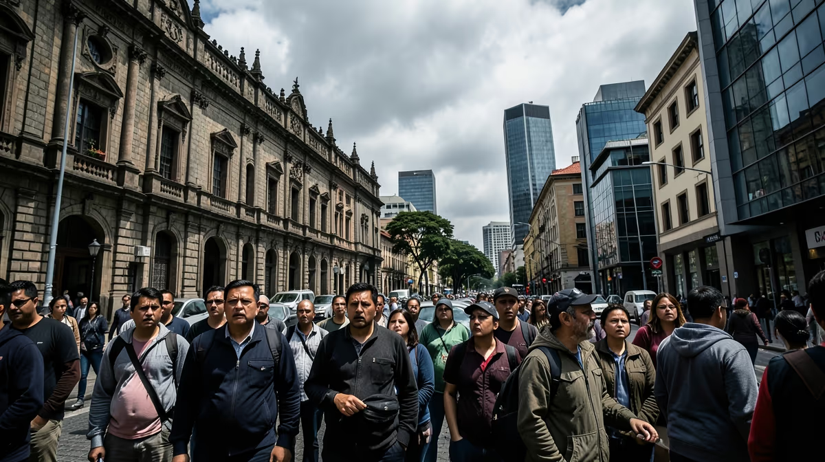
Tectonic forces deep beneath the Andean mountain range abruptly ruptured, sending violent shockwaves through central Colombia and testing the infrastructural endurance of major urban centers. As emergency response teams rushed to evaluate the damage, millions of residents confronted the sudden reality of a significant seismic event, making the search for verified colombia earthquake today information critical for regional stakeholders and international observers alike.
Seismic Overview and Epicenter Dynamics
A magnitude 6.3 earthquake struck central Colombia on Friday, shaking the capital city of Bogotá and prompting widespread evacuations, though U.S. geological monitors and local authorities reported no immediate widespread destruction or fatalities. The epicenter of the shallow quake was located near El Calvario in the Meta department, approximately 40 miles southeast of Bogotá, according to the U.S. Geological Survey. The strong tremors sent thousands of panicked residents pouring into the streets of the capital, temporarily disrupting transportation lines and communications networks in the Andean region. Emergency response teams were immediately deployed across several affected departments to assess structural integrity and check for potential landslides in mountainous terrain. While preliminary infrastructure assessments indicated minimal damage to critical public works, authorities advised residents to remain vigilant for potential aftershocks. The Colombian Geological Service recorded multiple smaller tremors following the main shock, prompting temporary precautionary closures of several buildings and government offices in Bogotá. In the United States, seismological institutions and the Department of State monitored the situation closely, offering assistance to local Colombian authorities as reports continued to trickle in from remote Andean communities near the epicenter.
Verification and Immediate Impacts
An earthquake recently struck Colombia, causing noticeable shaking in major cities as residents evacuated buildings and took to the streets as a safety precaution. Emergency response teams were immediately mobilized to assess potential damage while authorities checked critical infrastructure like roads and bridges for safety. Communications and updates remain ongoing as officials gather details from the epicenter. The confirmed facts establish that a magnitude 6.3 earthquake struck central Colombia on Friday with its epicenter near El Calvario in the Meta department. Tremors were strongly felt in the capital city of Bogotá, causing evacuations, while the U.S. Geological Survey monitored the depth and magnitude of the seismic event. Bogotá Mayor Claudia López urged calm during a televised address, stating that there were no reports of serious injuries or major structural collapses at that time, though citizens were asked to remain cautious during the initial sweep of the city neighborhoods. Comprehensive damage assessments from remote rural areas near the epicenter and the frequency and severity of potential aftershocks remain the primary developing elements of the situation.
Root Causes and Structural Vulnerabilities
The underlying mechanism of this event stems from tectonic subduction along the Nazca and South American plates, compounded by unmitigated urban sprawl in seismic zones lacking strict infrastructural enforcement. Colombia is situated in one of the most seismically active regions in the world, known as the Ring of Fire. The country geology is shaped by the complex interaction of three major tectonic plates, specifically the Nazca, South American, and Caribbean plates, whose constant shifting and subduction create frequent fault movements and subsequent earthquakes. This historical vulnerability parallels the 1999 Armenia, Colombia earthquake, which similarly exposed profound systemic housing vulnerabilities and catalyzed contentious reconstruction politics. Urban centers like Bogotá, which sits on an ancient lake bed that can amplify seismic waves and make shaking more noticeable to residents, face unique geological challenges that modern construction standards attempt to address.
Socioeconomic and Political Dimensions
Events of this nature strain national debt, redirect foreign direct investment away from infrastructure toward emergency reconstruction, and trigger surges in localized commodity pricing. Politically, such incidents can expose governmental failure regarding disaster preparedness, highlight the weaponization of relief funds by regional actors, and prompt the political deflection of infrastructural neglect. Geopolitically, these events influence shifts in regional dependency on U.S. and international humanitarian aid, provide potential leverage for non-state armed groups in remote disaster zones, and disrupt Andean supply chains. A hidden angle in these crises is the disproportionate displacement of marginalized rural and indigenous communities whose losses are systematically undercounted in national gross domestic product and casualty metrics. For people living in the United States, especially those with family and friends in Colombia, events like this cause immediate worry and highlight the unpredictable nature of natural disasters while prompting local groups and international networks to check in on loved ones and offer support. Residents living in the immediate impact zone in Colombia, particularly those near the epicenter and in older urban neighborhoods, are directly affected by property damage and service disruptions. Families abroad with relatives in the region are also impacted emotionally by concerns over safety and communication delays.
Future Outlook and Expert Projections
Seismologists expect a series of decreasing aftershocks over the coming days, with minimal direct physical impact on the US mainland but active diplomatic and humanitarian engagement. In the next 24 hours, U.S. geological agencies will continue monitoring aftershocks, while news outlets focus on initial damage reports from Colombia and any potential US citizen impacts. Over the next 72 hours, US humanitarian aid organizations and the State Department will assess requests for foreign assistance, and travel advisories for affected regions in Colombia may be updated. The key players involved in this monitoring include the US Geological Survey, the USAID Bureau for Humanitarian Assistance, the US Department of State, and the Colombian National Unit for Disaster Risk Management. The operational focus areas encompass emergency response coordination, travel and aviation advisories, diaspora community outreach, and foreign disaster assistance allocation. Under the best-case scenario, there will be minimal casualties and infrastructure damage in Colombia, requiring no major US financial or emergency deployment beyond routine monitoring. Conversely, the worst-case scenario involves major structural collapse in densely populated Colombian regions prompting immediate US search-and-rescue deployment and significant emergency funding requests.
Frequently Asked Questions
Was there a recent earthquake in Colombia?
Yes, Colombia experiences frequent seismic activity due to its location on the Pacific Ring of Fire. To get the most up-to-date information on very recent events, you should check real-time monitoring sites like the USGS website. These platforms provide immediate magnitude, epicenter, and depth details for any significant tremors.
Is it safe to travel to Colombia right now after the earthquake?
Most parts of Colombia remain safe for travelers, as daily life quickly resumes after minor to moderate seismic events. However, if a major earthquake has recently occurred, it is wise to monitor local news and official government travel advisories. Infrastructure in major cities like Bogota and Medellin is generally resilient, but rural areas may occasionally experience localized disruptions.
What was the magnitude of the latest earthquake in Colombia?
Earthquake magnitudes in Colombia vary constantly because the region records numerous small tremors every day. For the exact magnitude of the most recent felt earthquake, consulting the official United States Geological Survey or the Colombian Geological Service is recommended. They maintain live, verified logs of all seismic activity in the region.
Why are there so many earthquakes in Colombia?
Colombia is situated in one of the most seismically active regions in the world, known as the Ring of Fire. The country geology is shaped by the complex interaction of three major tectonic plates: the Nazca, South American, and Caribbean plates. This constant shifting and subduction create frequent fault movements and subsequent earthquakes.
Can you feel earthquakes in Bogota, Colombia?
Yes, earthquakes are frequently felt in Bogota due to the city specific geological foundation and proximity to active fault lines. Bogota sits on an ancient lake bed, which can amplify seismic waves and make shaking more noticeable to residents. Fortunately, modern construction standards in the capital are designed to withstand significant seismic stress.
Where was the epicenter of the last major Colombia earthquake?
Epicenters for Colombian earthquakes often occur along the Andean mountain range or off the Pacific coast where tectonic plates collide. Because the country has multiple active fault zones, significant tremors can originate in various departments like Santander, Meta, or Choco. Detailed maps and exact epicenter coordinates are routinely published by seismic monitoring agencies immediately following any notable event.
Conclusion
The magnitude 6.3 earthquake centered near El Calvario tested Colombia structural readiness and prompted widespread evacuations in Bogotá without causing immediate widespread destruction or fatalities. Geological agencies continue to monitor aftershocks while local authorities finalize damage assessments across Andean communities. International stakeholders, including U.S. and Colombian disaster response entities, remain engaged in tracking developments and ensuring infrastructural integrity as the region stabilizes.


