
Earthquakes Strike With Sudden Force That Leaves Experts Stunned
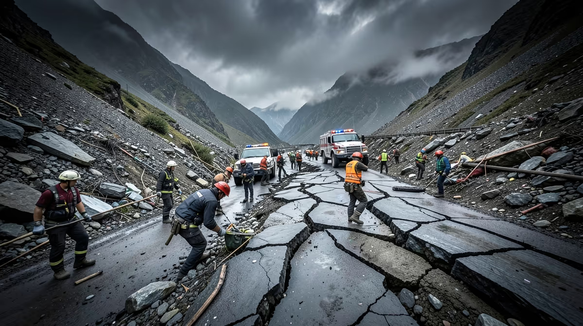
Deep beneath the surface of the Earth, centuries of accumulated tectonic strain can suddenly rupture without warning, releasing forces that reshape entire landscapes in seconds. Authorities are responding to a significant earthquake today as reports emerge regarding structural impacts and emergency response efforts worldwide. A powerful 7.4-magnitude earthquake struck the remote mountainous region of eastern Papua New Guinea early Wednesday morning, triggering localized landslides and widespread panic among residents, though immediate casualty figures remain unavailable. The US Geological Survey reported that the seismic event occurred at a depth of 62 kilometers, roughly 100 kilometers southwest of the coastal town of Wewak. Shaking was felt strongly across several provinces, causing temporary power outages and disrupting telecommunication lines in rural communities near the epicentre. Emergency response teams have been mobilized, but difficult terrain and blocked roads are severely hampering initial assessment efforts by national disaster management authorities. Seismologists warn that aftershocks measuring upwards of magnitude 5.0 are likely over the next 48 to 72 hours, posing continued risks to structurally compromised buildings in the affected zone.
Mechanics of Seismic Shaking
Earthquakes happen when massive pieces of the Earth's outer shell, called tectonic plates, suddenly shift and release trapped energy. This underground movement sends powerful shockwaves rippling through the ground, making the surface shake, roll, and sometimes split open. Depending on how deep and strong the shift is, the shaking can last from a few seconds to a couple of minutes. While minor tremors happen every day without us noticing, major earthquakes can cause sudden, widespread destruction to buildings, roads, and entire communities. The root cause of these events lies in tectonic plate boundary interactions driven by mantle convection, specifically along subduction zones and continental transform faults, exacerbated by anthropogenic subterranean stress factors like fluid injection and mining. Earth has experienced powerful earthquakes for billions of years as its crust slowly reshapes itself. Over the last century, modern science and engineering have allowed us to map fault lines and build much stronger structures, greatly reducing the loss of life compared to ancient times.
Immediate Response and On-Ground Developments
National Disaster Management Office Director John Paska stated during an emergency briefing in Port Moresby, our primary focus right now is establishing contact with remote villages near the epicentre. Search and rescue helicopters are on standby, but heavy cloud cover is currently delaying deployment. The US Geological Survey confirmed that the 7.4-magnitude earthquake struck eastern Papua New Guinea on Wednesday, with the hypocenter recorded at a depth of 62 kilometers. The epicentre was located approximately 100 kilometers southwest of Wewak, where tremors caused temporary power outages and landslides in rural areas. While the exact magnitude and epicentral location of the primary earthquake have been officially verified, along with confirmation of localized property damage and disrupted communications in the highlands, the full extent of casualties, structural damage in remote mountain villages, and the trajectory of potential aftershocks remain ongoing developments. People living near major tectonic fault lines worldwide, particularly in densely populated urban areas with older or non-earthquake-proof buildings, are most at risk during a seismic event.
Socio-Economic and Geopolitical Fallout
Major earthquakes strike without warning, making them one of nature's most destructive and terrifying hazards. They can instantly knock out power, shatter infrastructure, and trap people in collapsed buildings, leading to severe humanitarian crises that require massive rescue and relief efforts. From an economic perspective, catastrophic infrastructure destruction triggers localized debt crises, spikes in global reinsurance premiums, supply chain disruptions in manufacturing hubs, and long-term capital diversion toward reconstruction over development. Politically, disaster response capabilities reflect state capacity and governance quality, where slow or corrupt aid distribution often triggers domestic political instability, regime vulnerability, and armed opposition mobilization. Geopolitically, calamities often catalyze disaster diplomacy which can temporarily thaw bilateral rivalries, yet severe economic debilitation can also invite predatory foreign aid, strategic dependency, and the militarization of humanitarian relief. A hidden angle involves the securitization of seismic data and early-warning technologies, where critical sub-surface monitoring networks are classified or withheld due to dual-use military applications in nuclear test ban verification. Historically, events like the 1976 Tangshan earthquake in China fundamentally tested the limits of centralized state control, accelerated political transition dynamics, and ultimately reshaped the nation's economic openness.
Future Outlook and Geological Monitoring
The timeline of seismic events spans from centuries of tectonic strain accumulation along locked fault segments to the sudden seismic slip releasing mega-thrust energy and generating surface rupture, immediately followed by humanitarian crisis, communication blackout, and localized institutional collapse. International aid mobilization then intersects with geopolitical posturing and sovereignty concerns, while post-disaster reconstruction cycles drive long-term debt accumulation and structural societal shifts. For the immediate future, ongoing aftershocks in moderate seismic zones are expected with magnitudes remaining below major damaging thresholds, accompanied by continuous micro-seismic monitoring over the next 24 hours. Looking toward the next 72 hours, priorities will shift to the assessment of regional fault lines for stress transfer, ongoing deployment of rapid-response geological survey teams, and public awareness updates. Key players involved in these monitoring and response efforts include the USGS, the European-Mediterranean Seismological Centre, local emergency management agencies, and seismological research institutes across the Ring of Fire active zones and the Mediterranean seismic belt. Expert prediction indicates that standard background seismicity will continue globally with a normal distribution of moderate earthquakes and no immediate indicators of an imminent catastrophic mega-thrust event. The best-case scenario envisions all seismic activity remaining at low-to-moderate levels with zero casualties, minimal property damage, and successful data collection for scientific models, whereas the worst-case scenario warns that a high-magnitude unexpected shallow earthquake could strike a densely populated urban area, causing significant infrastructure collapse and overwhelming local emergency response networks.
Frequently Asked Questions
What causes earthquakes to happen?
Earthquakes are primarily caused by the sudden movement of tectonic plates along fault lines beneath the Earth's surface. As stress builds up over time because these massive slabs of rock push against each other, it eventually exceeds the friction holding them in place. The resulting release of energy sends seismic waves radiating through the ground, creating the shaking we feel.
Where do most earthquakes occur in the world?
The majority of the world's earthquakes occur along the Ring of Fire, a horseshoe-shaped basin in the Pacific Ocean. This region is home to numerous tectonic plate boundaries where subduction zones and transform faults generate intense seismic activity. Countries like Japan, Indonesia, and the western coast of the Americas experience frequent tremors due to this geological setting.
How are earthquakes measured?
Earthquakes are measured using seismographs, which record the seismic waves generated by the underground movement. Scientists use the Moment Magnitude Scale to quantify the total energy released by an earthquake, which replaced the older Richter scale. This modern scale provides a more accurate representation of the quake's true size, especially for very large events.
Can scientists predict when an earthquake will happen?
Currently, scientists cannot accurately predict the exact time, location, and magnitude of future earthquakes. While seismologists can identify high-risk zones and calculate the probability of a major event occurring over a span of decades, short-term prediction remains scientifically impossible. Instead, early warning systems are deployed to detect initial seismic waves and provide seconds to minutes of alert before strong shaking arrives.
What should you do during an earthquake?
During an earthquake, the safest immediate action is to drop, cover, and hold on. Get under a sturdy piece of furniture like a heavy desk or table, protect your head and neck, and hold on until the shaking stops. If you are outdoors, move away from buildings, streetlights, and utility wires to an open area.
What is the difference between the epicenter and the focus?
The focus, or hypocenter, is the exact point underground where the earthquake's rupture and energy release originate. In contrast, the epicenter is the point on the Earth's surface directly above the focus. News reports usually reference the epicenter when describing the location of an earthquake.
Conclusion
The verified developments surrounding the 7.4-magnitude earthquake in Papua New Guinea highlight the ongoing vulnerability of remote communities to sudden seismic activity. Confirmed impacts include localized landslides, temporary power outages, and disrupted telecommunication lines, while national disaster management authorities continue their efforts to assess the affected highlands. Realistic next steps involve ongoing micro-seismic monitoring, the deployment of survey teams to evaluate regional fault lines, and continued search and rescue operations as weather conditions permit.


