
2026 Super El Nino Forecast Signals Major US Weather Disruptions
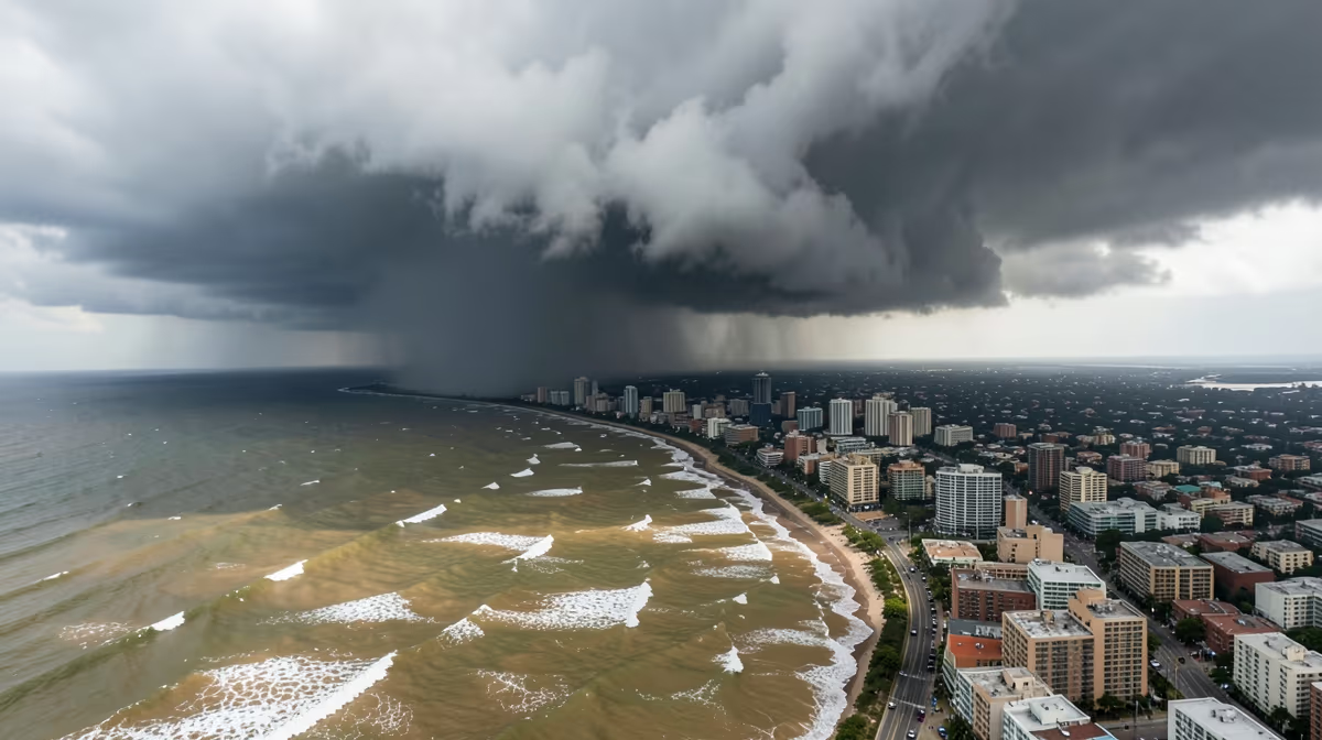
As meteorologists monitor Pacific Ocean temperatures, the latest 2026 super el nino forecast suggests significant climate shifts are on the horizon for the United States. Meteorologists are warning that lingering atmospheric signals could trigger a historically powerful Super El Niño event across the United States by late 2026, threatening severe weather disruptions from coast to coast.
The Mechanics Of Pacific Climate Shifts
El Niño is a naturally occurring climate phenomenon characterized by warmer-than-average sea surface temperatures in the central and eastern tropical Pacific Ocean. Forecasters note that transition phases from the current La Niña pattern often pave the way for rapid oceanic warming, setting the stage for significant global weather shifts. If current computer models hold true, the impending phase could rival the intensity of the record-breaking 2015-2016 event.
A Super El Niño is driven by a severe weakening or reversal of the easterly trade winds blowing across the tropical Pacific Ocean. This disruption allows massive pools of warm water to slosh eastward from Australia toward the coast of South America. The resulting massive release of heat into the atmosphere alters global jet streams and weather patterns. Unprecedented ocean heat accumulation in the Western Pacific warm pool coupled with a rapid collapse of trade winds triggers this hyper-charged cycle.
Scientists use sophisticated coupled ocean-atmosphere computer models to monitor subsurface ocean temperatures, wind patterns, and atmospheric pressure anomalies. These numerical models ingest vast amounts of historical data and real-time buoy measurements from the Tropical Pacific Observing System. While short-term forecasts are quite accurate, predicting exact intensities like a super El Nino years out has limited reliability. Oceanic and atmospheric cycles are currently shifting away from La Niña conditions, and meteorological agencies are actively monitoring Pacific sea surface temperature trends for 2026.
Potential Impacts On US Weather And Temperature Trends
For the United States, a Super El Niño typically translates to a distinct geographical division in weather impacts. The southern tier of the country, including California and the Gulf Coast, generally experiences above-average precipitation and storm activity, which can help alleviate drought but also increase the risk of severe flooding and mudslides. Conversely, the Pacific Northwest and the Ohio Valley often see warmer and drier conditions.
If a super El Nino develops by late 2026, it typically brings distinct weather anomalies across the United States. The northern tier of the US and parts of the Midwest often experience warmer and drier conditions, while the southern states, including California and the Gulf Coast, usually see significantly increased rainfall and storm activity.
Virtually everyone in the US will feel some impact, but specifically, farmers in the Midwest and West dealing with water availability, residents in the southern states facing heavy winter storms and flooding, and coastal communities vulnerable to severe weather and rising sea temperatures will experience the brunt of these shifts.
Socioeconomic And Infrastructure Vulnerabilities
Agriculture, energy markets, and municipal emergency management agencies are already reviewing contingency plans in response to the long-range outlook. While winter impacts are months away, early preparation is considered crucial for mitigating potential infrastructure damage and safeguarding agricultural yields across vulnerable regions.
This matters because a Super El Niño acts as a master switch for extreme weather, directly threatening homes, wallets, and safety. Farmers could face severe crop disruptions from unseasonal droughts or floods, energy grids will be strained by extreme temperature swings, and coastal communities face heightened risks of severe storms and erosion, ultimately driving up the cost of food, insurance, and disaster recovery for everyday Americans.
Economic implications point toward trillion-dollar disruptions to US agricultural output in the Midwest, skyrocketing insurance premiums in disaster-prone coastal and southern states, and severe supply chain bottlenecks along the Mississippi River. Furthermore, acute strain on domestic critical infrastructure can occur, specifically affecting the cooling water capacities of nuclear and fossil-fuel power plants in the US interior during extreme heatwaves, threatening systemic grid failures.
Political And Geopolitical Pressures
The political dimension involves the federal administration facing catastrophic domestic disaster relief strains ahead of mid-term elections, shifting federal resource allocation and weaponizing FEMA funding debates in Congress. On the international stage, the US may leverage its emergency food reserves as a tool of soft power while facing accusations of hoarding grain as global agricultural markets crash, straining trade relations with Latin American and Asian import partners.
Historical parallels provide context, most notably the severe 1997-1998 Super El Niño, which caused global weather chaos, billions in agricultural losses, and forced massive emergency geopolitical realignments. Similarly, the 2015-2016 event caused major disruptions to global weather patterns.
Monitoring And Near-Term Outlook
Meteorological agencies are scheduled to release updated sea surface temperature anomaly models for the Pacific basin within the next 24 hours. Over the next 72 hours, climate scientists will convene to analyze equatorial subsurface heat content and assess transition probability to a Super El Niño by late 2026.
Current oceanic indicators suggest a high likelihood of transitioning from ENSO-neutral to a strong or super El Niño phase by the peak of the 2026 winter season, prompting early warnings for extreme weather volatility. The best case scenario involves moderate warming bringing beneficial drought relief and water resource replenishment to the Western US without causing severe flooding or infrastructure damage. The worst case scenario features a rapid transition to a Super El Niño triggering catastrophic atmospheric rivers, widespread flooding in California, severe agricultural disruptions, and multi-billion-dollar infrastructure damages.
The exact peak intensity, precise timing of onset, and specific localized impacts of the projected 2026 El Niño remain subject to ongoing data collection and seasonal model updates. While long-range forecasts this far in advance carry inherent uncertainty, the velocity at which ocean temperature anomalies are developing demands attention from policymakers and researchers alike.
Frequently Asked Questions
Is a super El Nino forecasted for 2026?
Current climate models and NOAA observations indicate that it is still too early to definitively forecast a super El Nino for 2026. Forecasters typically wait until late spring or summer of the preceding year to gauge equatorial Pacific sea surface temperatures with high confidence. While cyclical patterns suggest a potential shift away from La Nina, predicting an extreme super event this far in advance remains speculative.
How will a 2026 super El Nino affect US weather?
If a super El Nino develops by late 2026, it typically brings distinct weather anomalies across the United States. The northern tier of the US and parts of the Midwest often experience warmer and drier conditions, while the southern states, including California and the Gulf Coast, usually see significantly increased rainfall and storm activity.
When did the last super El Nino occur?
The most recent super El Nino event occurred during the winter of 2023-2024, ranking among the strongest ever recorded globally. This event contributed significantly to record-breaking global temperatures in 2024. Prior to that, the last major super El Nino events took place in 2015-2016 and 1997-1998.
Will a 2026 El Nino impact the US hurricane season?
Yes, a strong El Nino typically suppresses Atlantic hurricane activity by increasing vertical wind shear across the Caribbean Sea and tropical Atlantic. Conversely, it tends to enhance hurricane and typhoon activity in the Pacific basin. However, the exact impact on the 2026 season will depend on the timing and intensity of the climate pattern.
What causes a super El Nino event?
A super El Nino is driven by a severe weakening or reversal of the easterly trade winds blowing across the tropical Pacific Ocean. This disruption allows massive pools of warm water to slosh eastward from Australia toward the coast of South America. The resulting massive release of heat into the atmosphere alters global jet streams and weather patterns.
How do scientists predict El Nino years in advance?
Scientists use sophisticated coupled ocean-atmosphere computer models to monitor subsurface ocean temperatures, wind patterns, and atmospheric pressure anomalies. These numerical models ingest vast amounts of historical data and real-time buoy measurements from the Tropical Pacific Observing System. While short-term forecasts are quite accurate, predicting exact intensities like a super El Nino years out has limited reliability.
Conclusion
As meteorological agencies continue monitoring Pacific sea surface temperature trends and equatorial subsurface heat content, the probability of transitioning toward a significant ENSO phase by late 2026 remains a critical focal point for researchers, agricultural markets, and emergency management planners. While long-range forecasting carries inherent uncertainty, ongoing evaluation of computer models and oceanic indicators will guide preparedness strategies across vulnerable sectors. Stakeholders across agricultural, energy, and municipal sectors are advised to track official updates from climate prediction centers as new observational data becomes available.


